6/20/16 Mount Baden-Powell is one of the most prominent peaks in the San Gabriels, and features some amazing views. Unfortunately, the views on this day were marred by smoke from a wildfire. Almost 22 miles and 6,000' gain in 90+ degree temps, plus some added excitement from the wildfire, made for a very long day.
1 
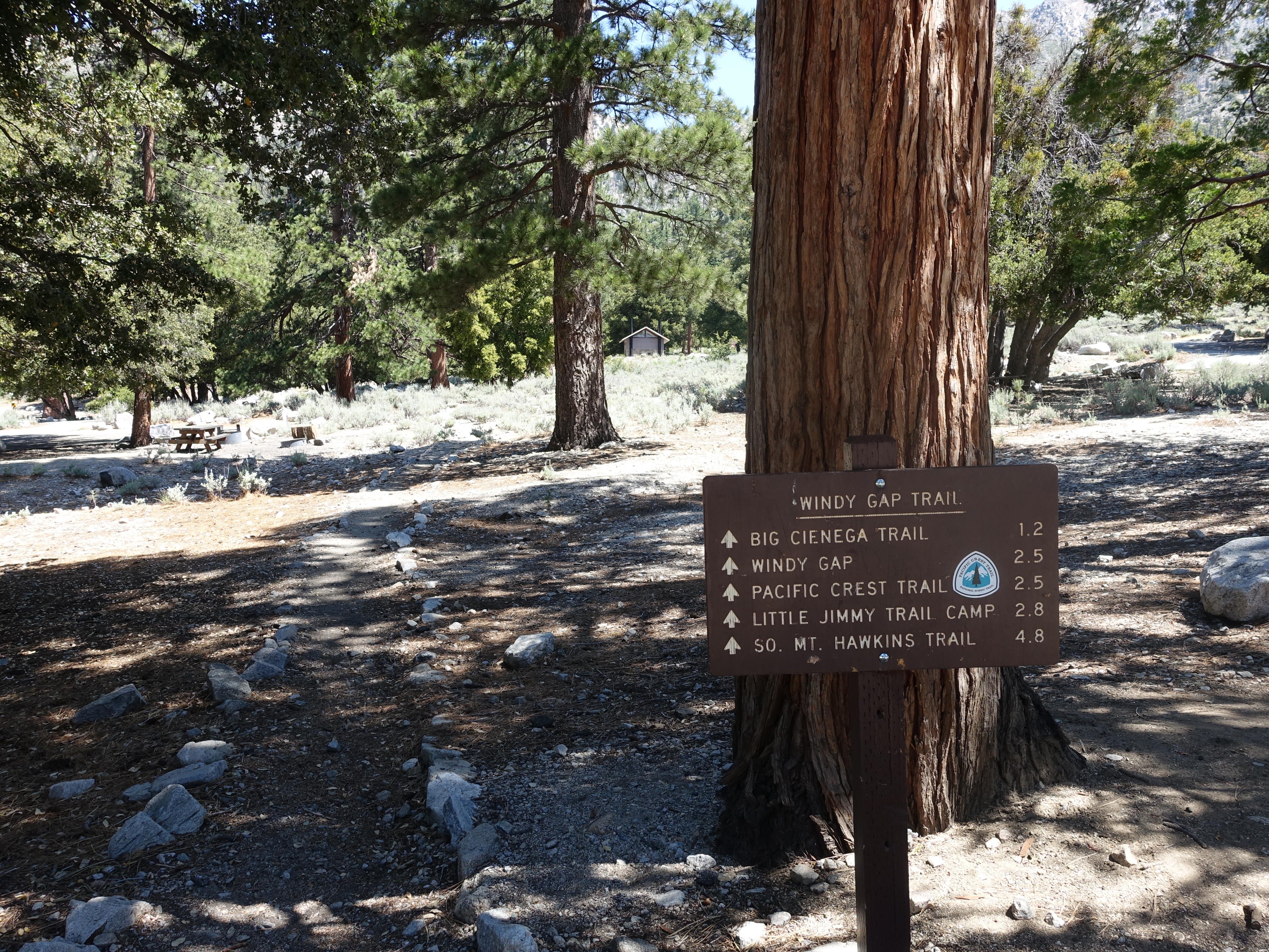
Hitting the trail just after 11:00am at right around 6,000'. A late start, but it was going to be a quick day (or so I thought). The temps at the trailhead were in the low 90s. I was the only car in the parking lot, so it looked like I may have the trail to myself today.
2 
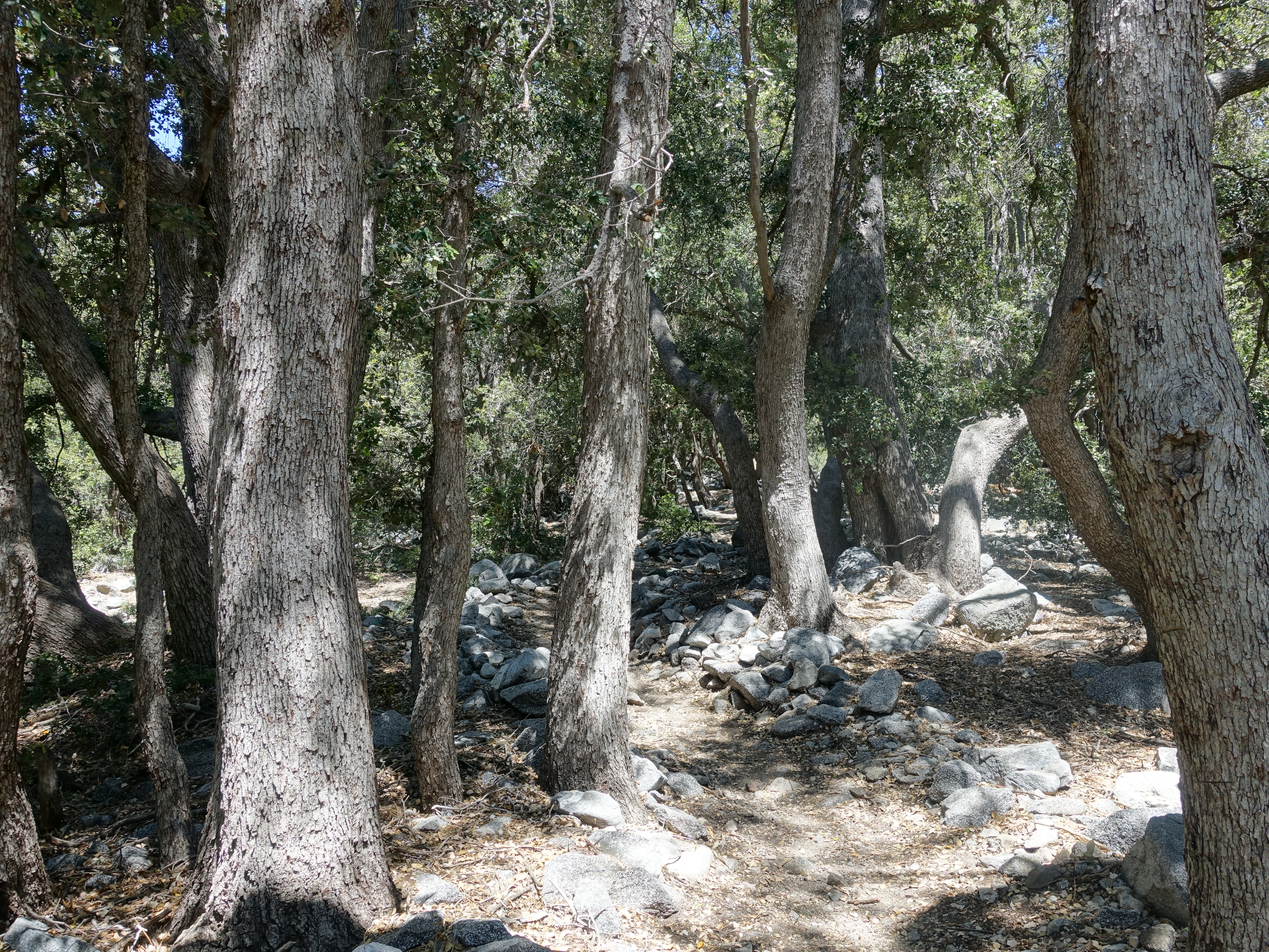
Beautiful singletrack on the lower portion of the Windy Gap trail.
3 A look up at Windy Gap. Still a long ways to go.
4 
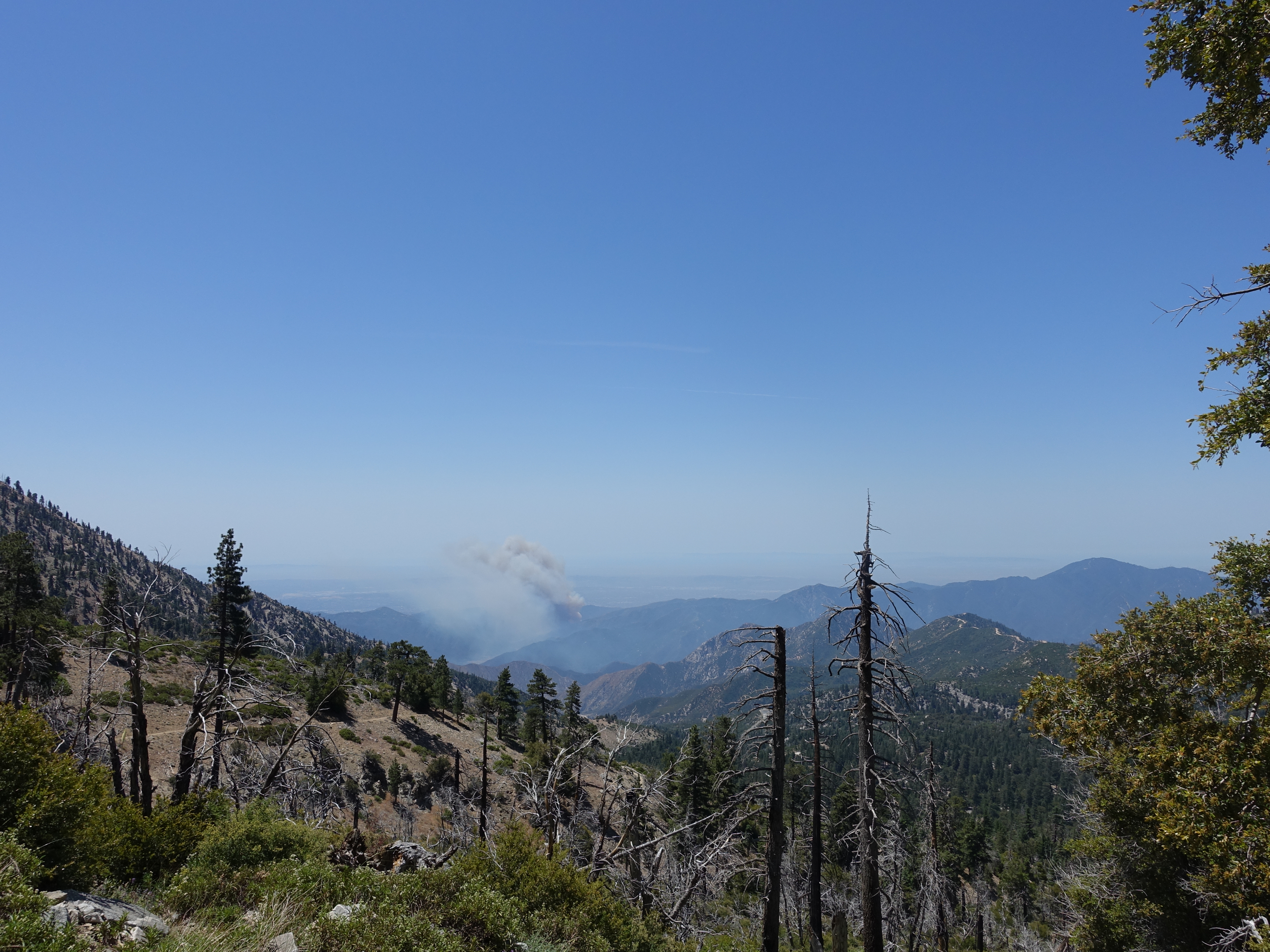
On the way up to the gap I noticed what looked like a wildfire starting in the distance. Then by the time I was a little further up the trail, a second fire had started. It looked like it was in the area of Highway 39, and I hoped it wouldn't close the highway. I briefly thought about heading back down, but decided against that and continued on.
5 Almost up to the gap.
6 Made it to Windy Gap at 7,588'. Smoke from the fires is starting to fill San Gabriel Canyon. So much for clear views today.
7 A look to the other side of the gap, unaffected by the smoke.
8 
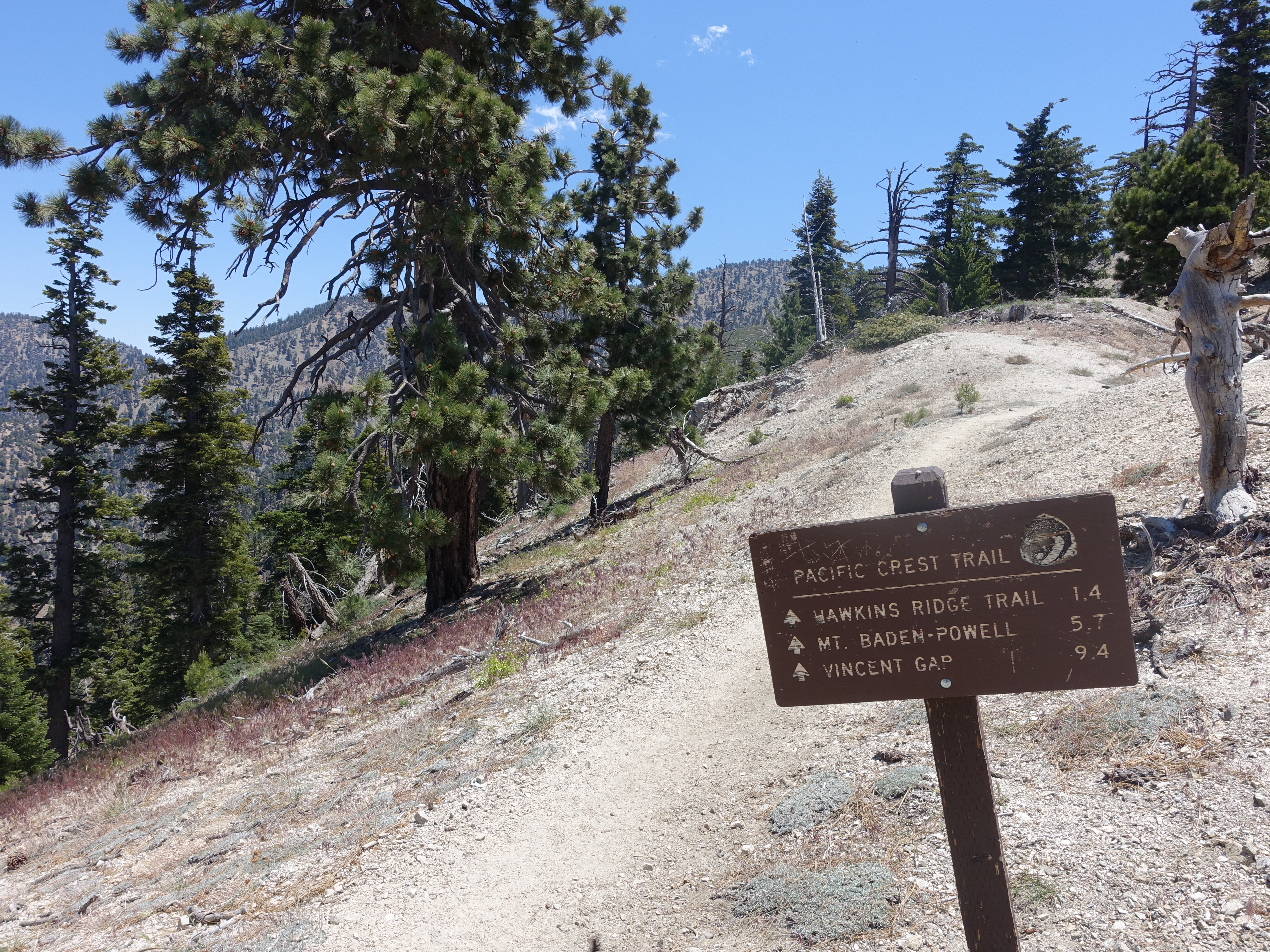
On the PCT now. It was somewhere around here that I can ran across the only person I saw on the entire trail. It was a PCT thru-hiker heading North. He had just come up and over Mount Baden-Powell in the heat, was not looking too good, and was really low on water. I gave him a little bit of water from my pack bladder, which I was happy to do at the time. Turns out I would miss it later in the day.
9 
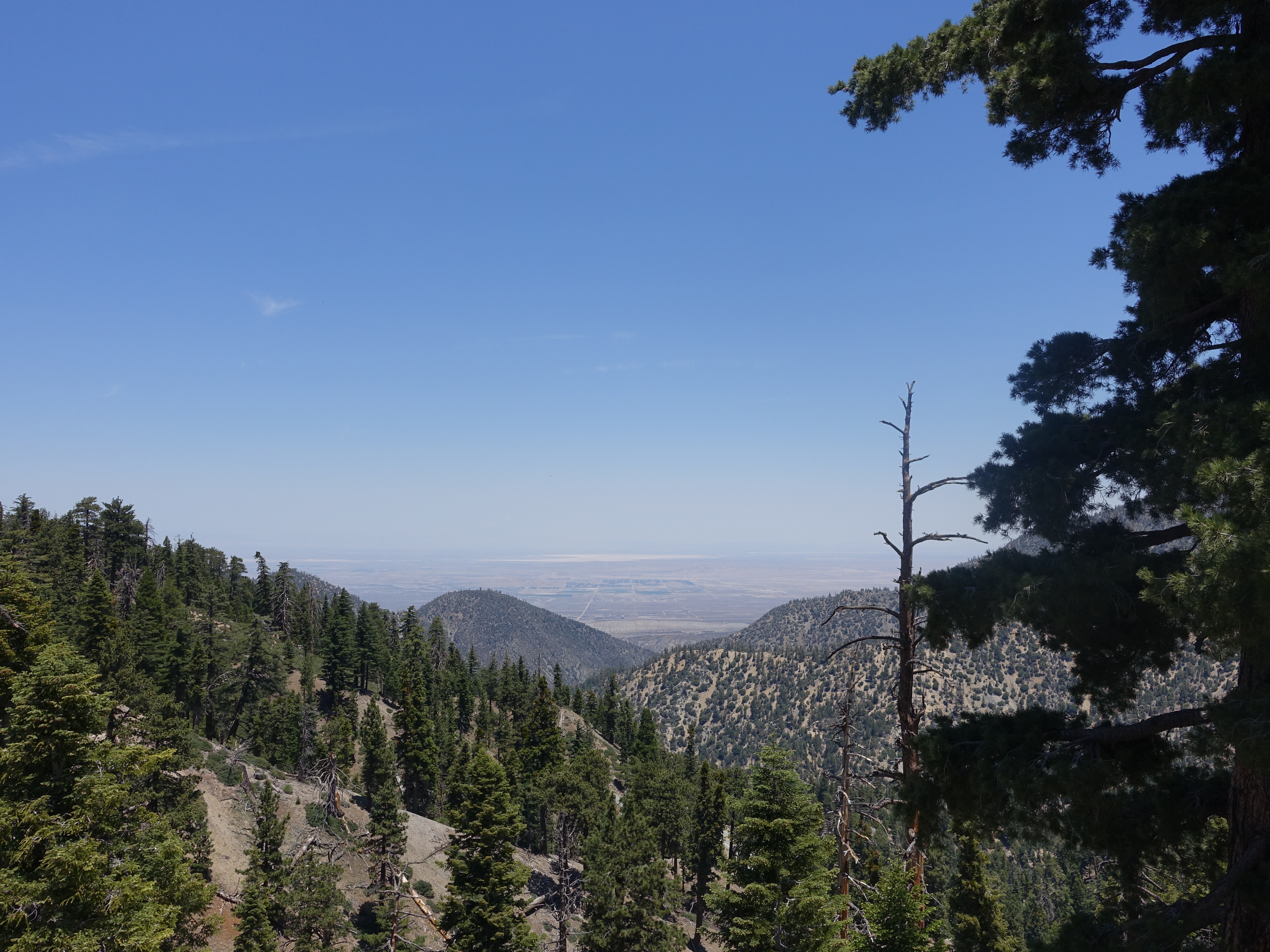
There are fantastic outlooks all along the trail for the next few miles. On a clear day, you can see all the way out to the ocean and Catalina. Not so much today. You can compare these photos to my previous trip up here on a clear day.
10 
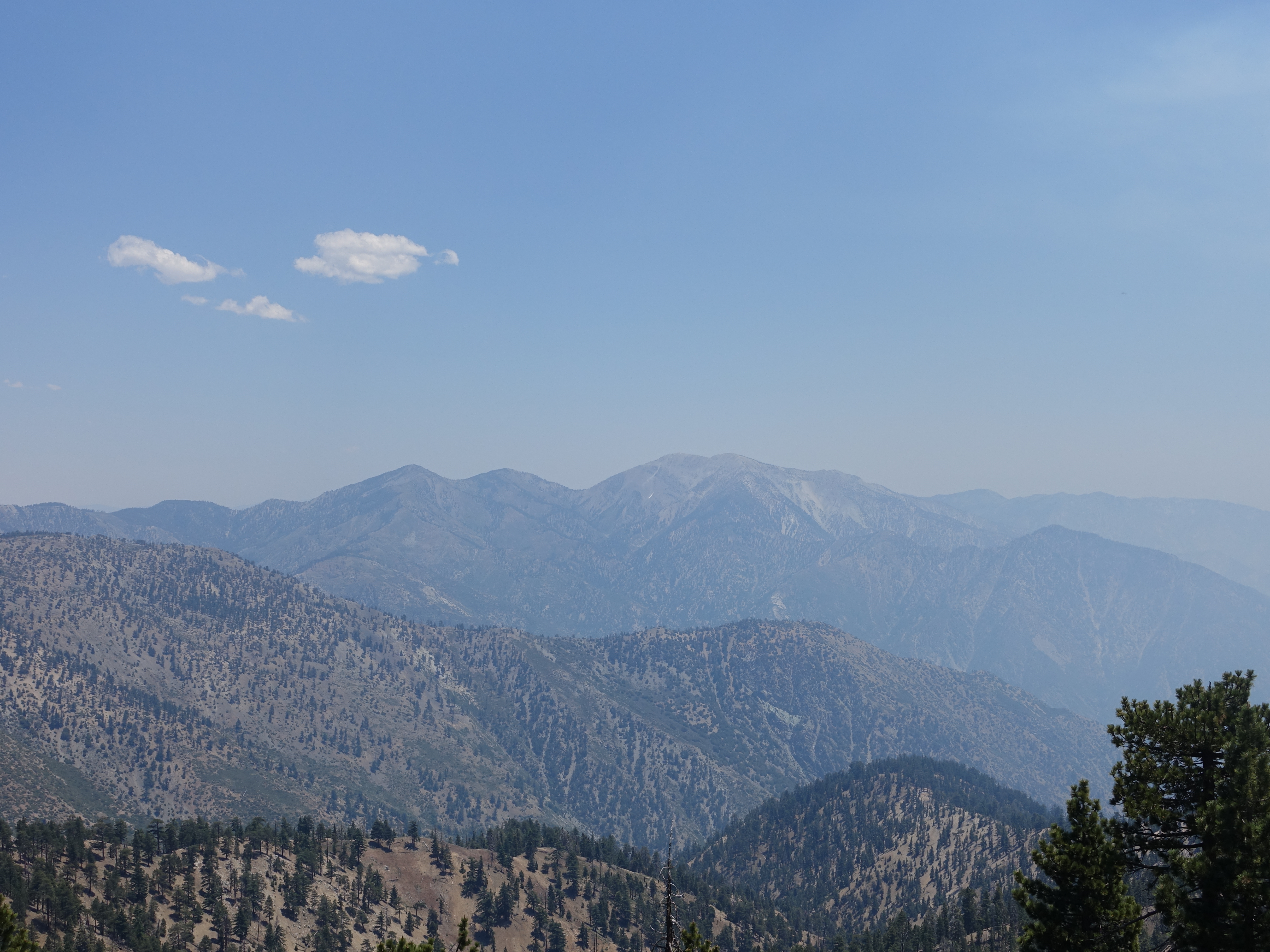
First (hazy) views of Mt. Baldy.
11 
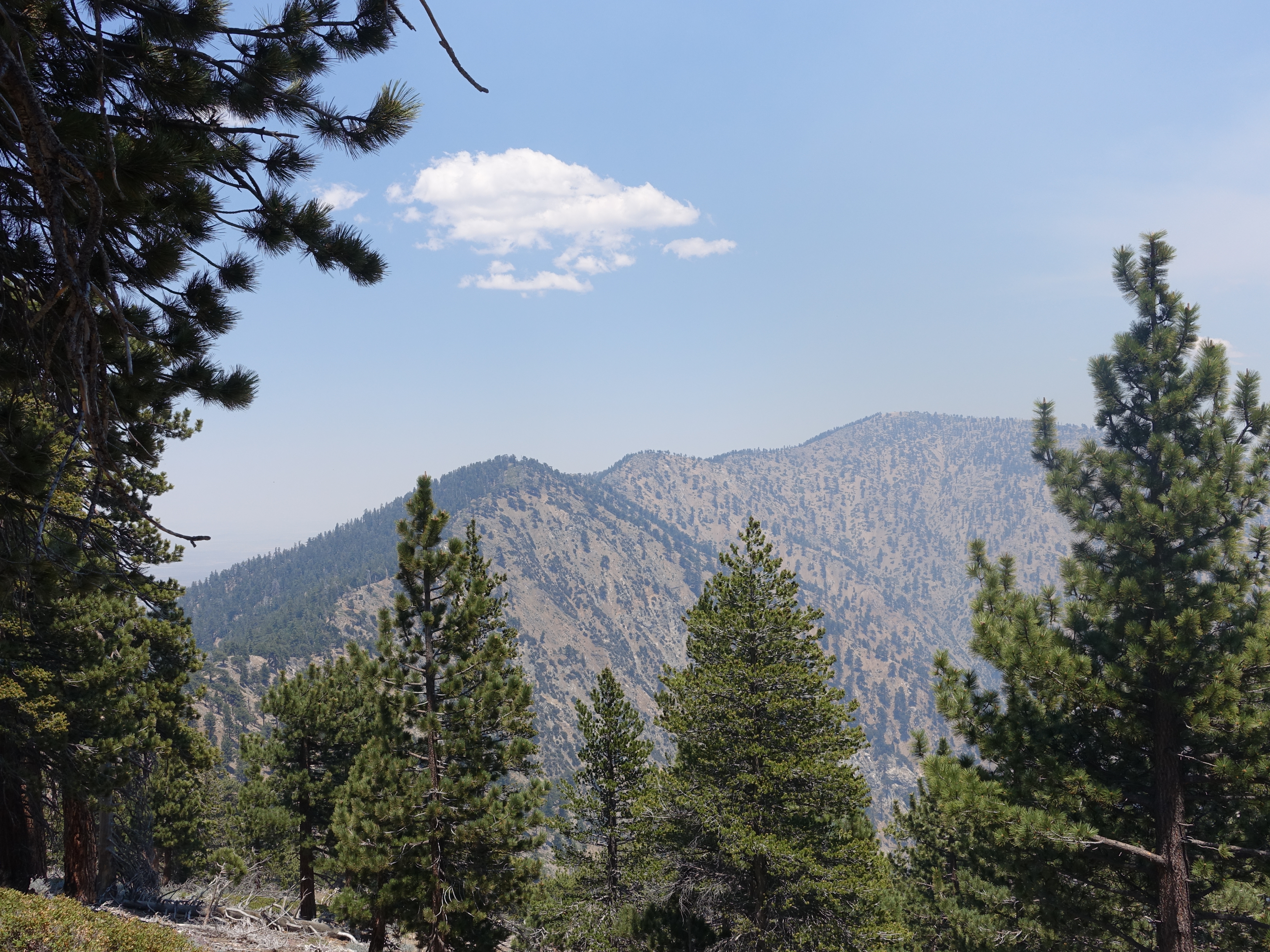
First view of Mount Baden-Powell.
12 Expansive views of Mt. Baldy and Iron Moutain (to the right).
13 The ridge leading up to Baden-Powell. The dips mean there's uphill on the way back, which is never fun.
14 
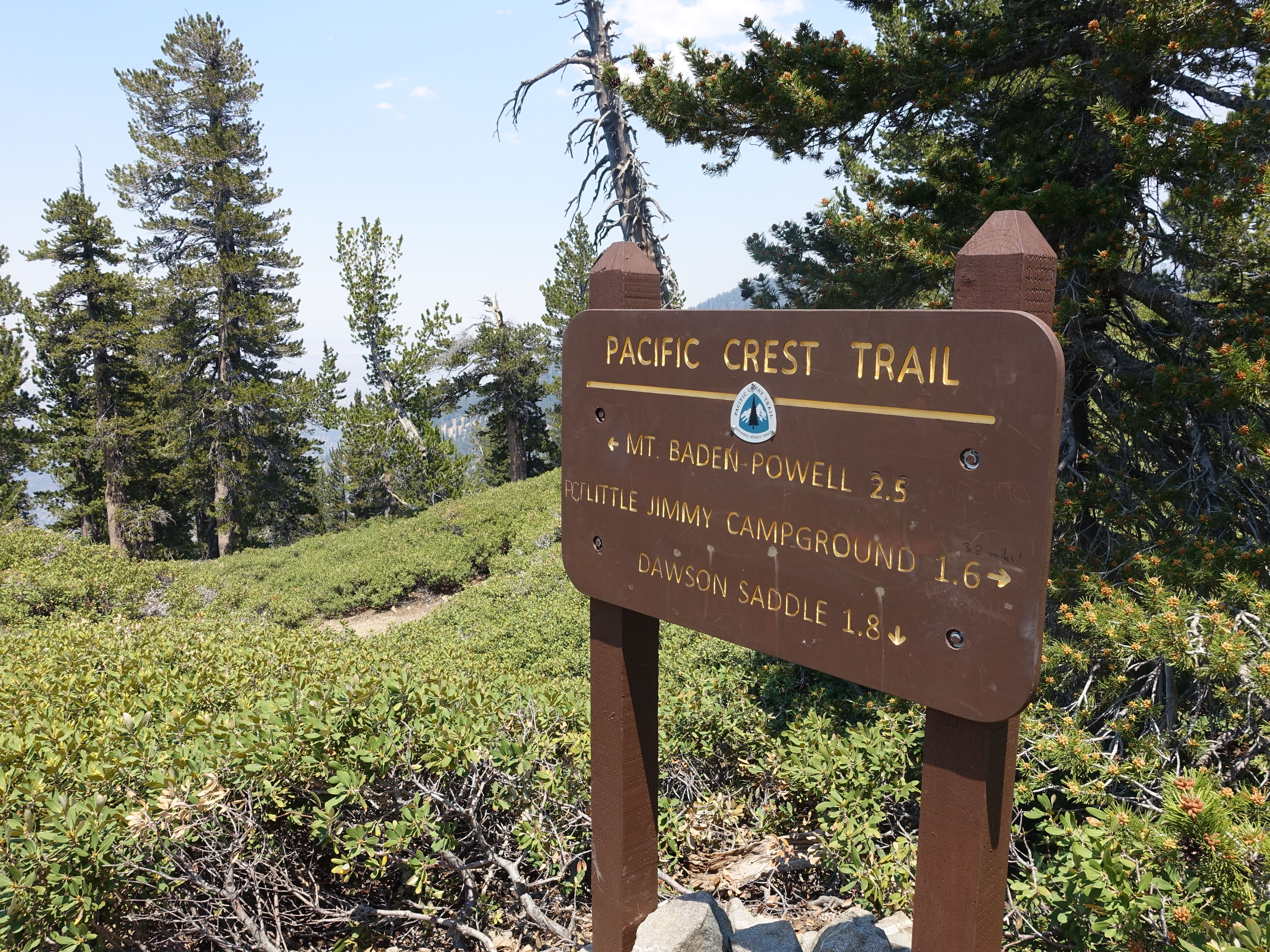
Still 2.5 miles to go. It's just after 2:00pm, so I'm doing pretty well time-wise considering the heat.
15 
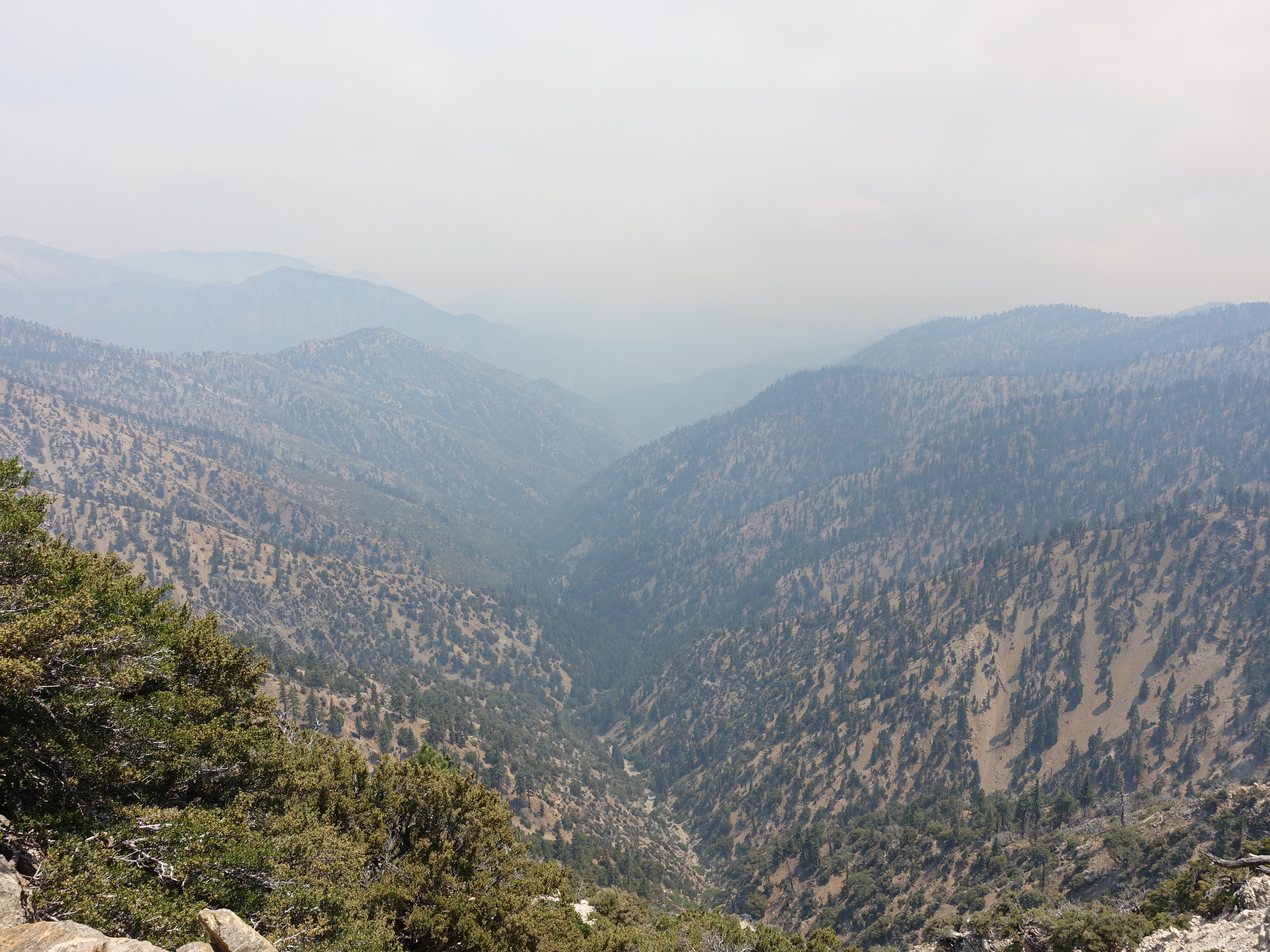
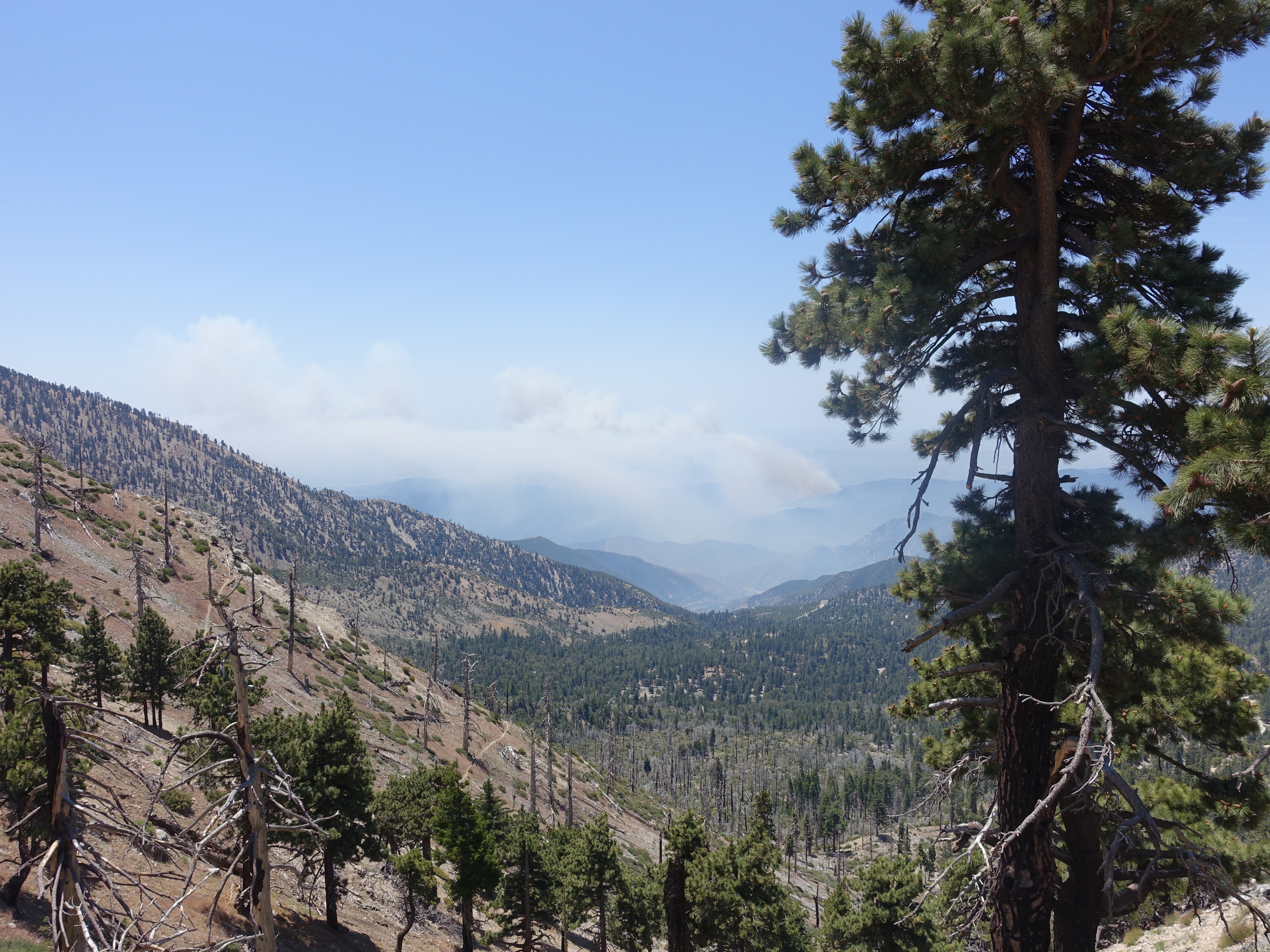
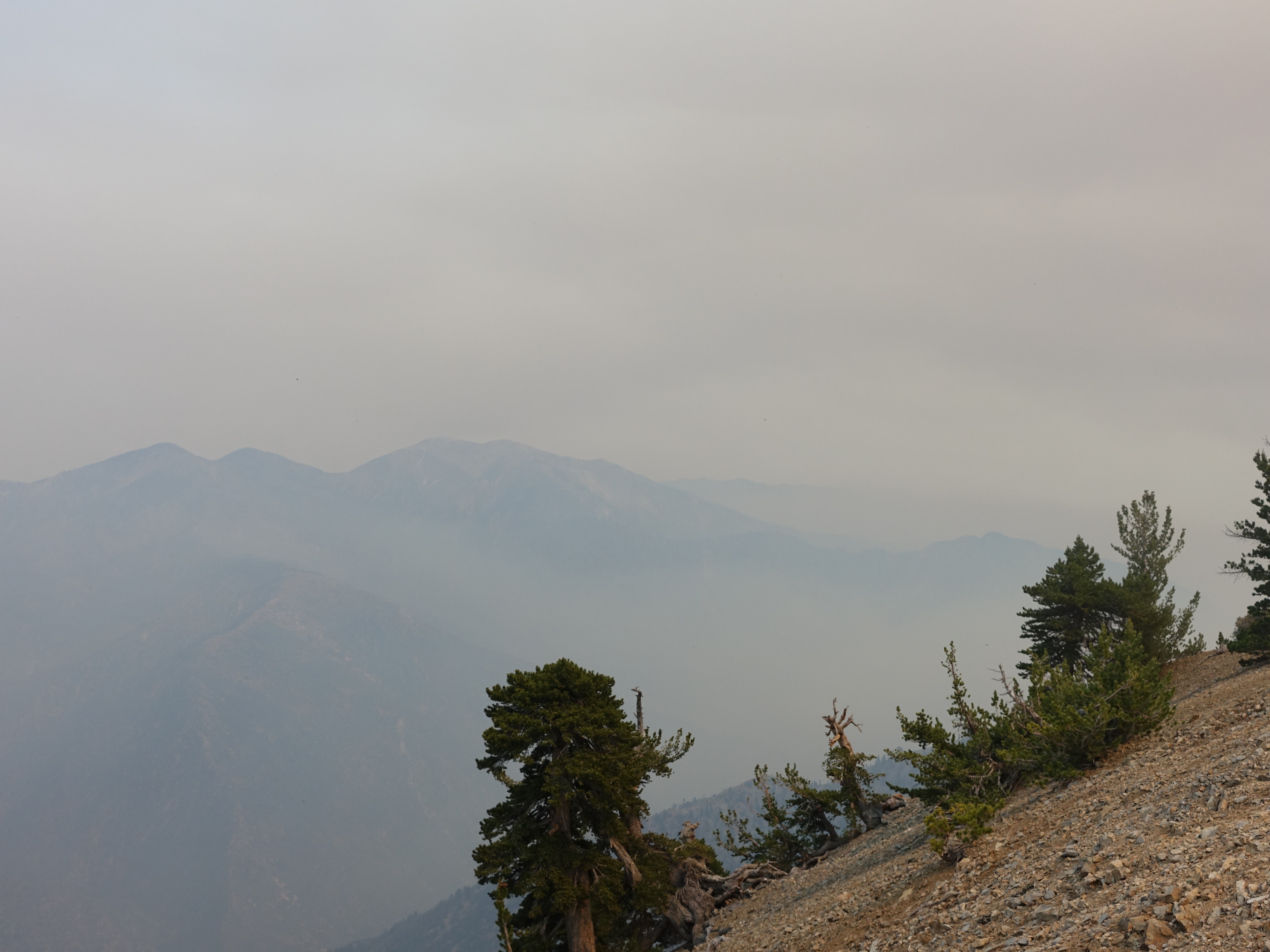
Another canyon view filled with smoke from the fires. You can distinctly smell the fire now and I'm sure the smoke isn't helping my breathing any at this altitude.
16 Up and down the humps of the ridgeline.
17 
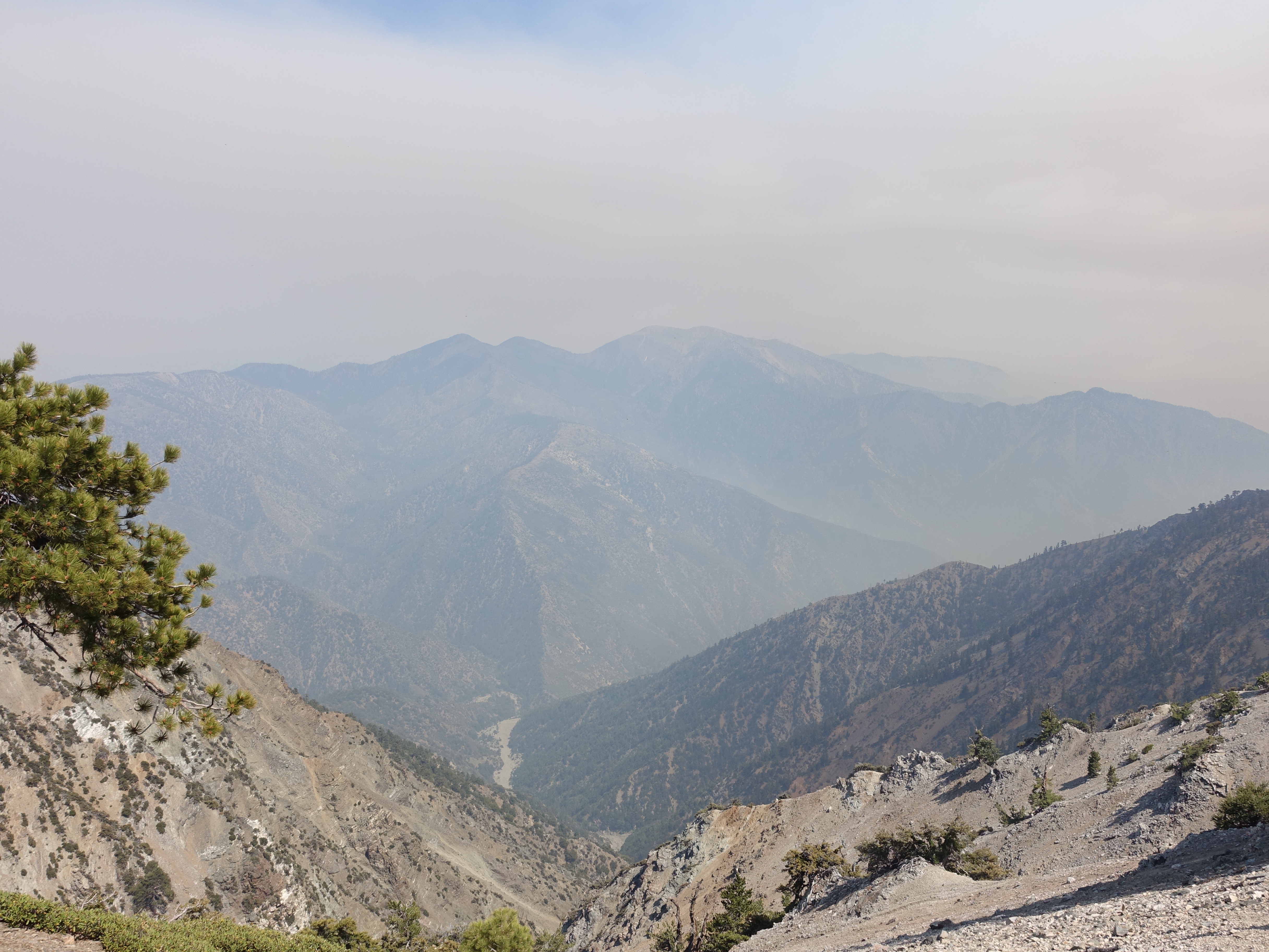
A look down the East Fork of San Gabriel Canyon. One of the deepest canyons in the country and deeper than the Grand Canyon. Also a great look at San Antonio ridge leading from Iron Mountain to the Baldy summit. Too bad it's not a clear day.
18 
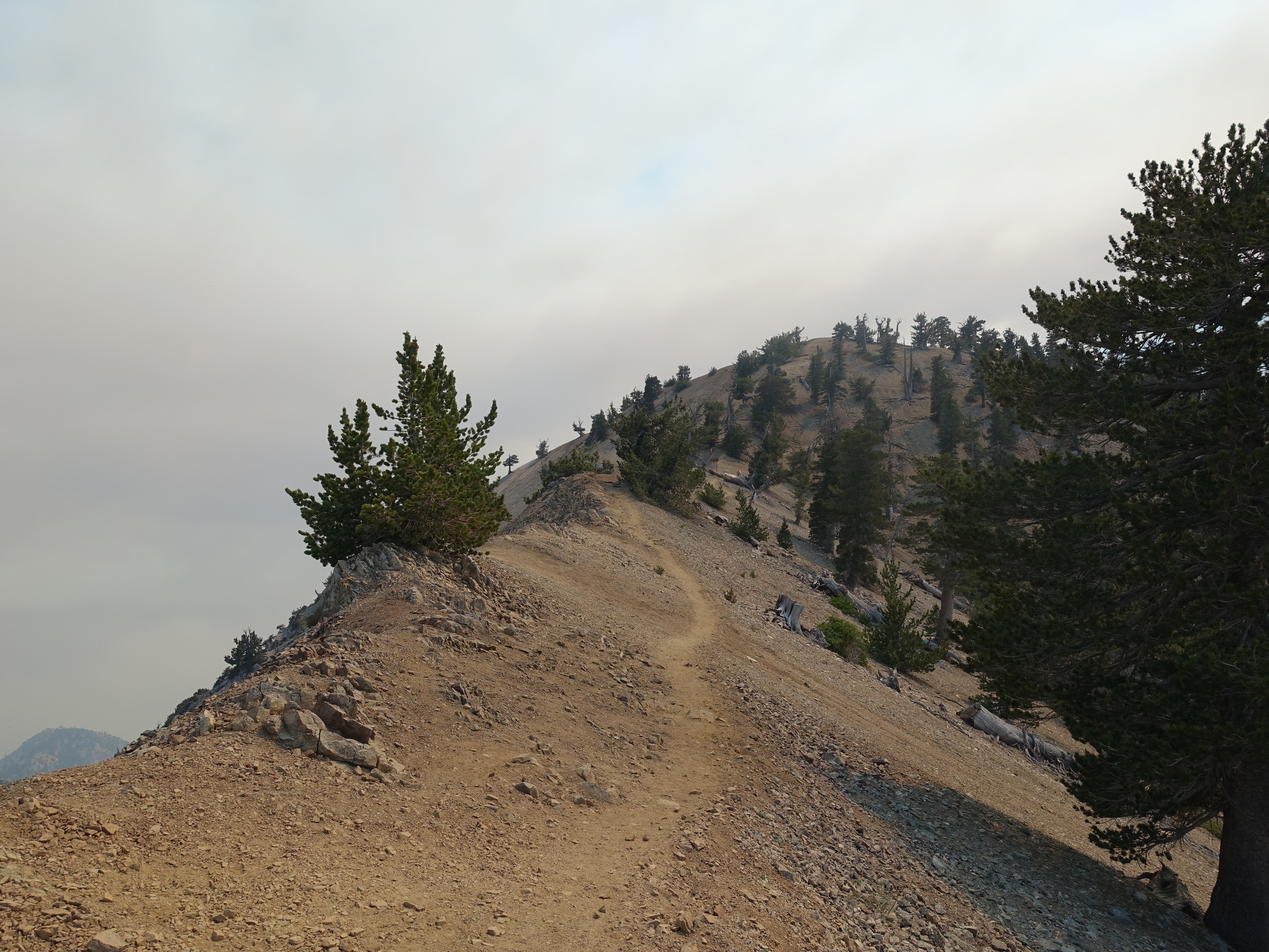
Approaching the Mount Baden-Powell summit.
19 Made it at around 3:30pm. 9,399'. Here is the tribute to Lord Baden-Powell, founder of the Boy Scouts.
20 The smoky view of Mt. Baldy and Iron Mountain from the Baden-Powell summit.
21 Official summit marker.
22 Obligatory 360 summit video. There was one other person on the summit, who had come-up the short (but steep) route from Vincent Gap.
23 Headed back down now at around 4:15pm. Here's the famous Wally Waldron tree. A Limber Pine estimated to be 1,500 years old.
24 On the way back I deciced to try to bag a few of the peaks that have use trails forking off the main trail. Here's the summit of Mt. Burnham at 8,957'.
25 And here's a look back at Mount Baden-Powell from the Mt. Burnham summit. The use trail was pretty hard to follow, but I eventually made it back down to the PCT.
26 The next peak along the way was Throop Peak. It added another 400' of gain to my trip, but was fun to find this tribute. The use trail down the other side was really hard to follow though. I was wondering if I shouldn't just backtrack and head down the way I came-up. Turns out I definitely should have.
27 After a while, I rejoined what I thought was the PCT. The ridgeline looked similar, but things just didn't feel right, and I seemed to be heading too far North. I finally pulled-out the map and realized I must have come over Throop Peak and ended-up on the Dawson Saddle trail. By the time I realized this, I was almost all the way down to Highway 2. Here's the trailhead at the highway. Unfortunately, my blunder ended-up adding 3.6 miles and 1,800' of gain to the day when I was already getting tired and low on water.
28 After a tough climb, I finally made it back to the real PCT and headed back along the ridgeline. It's now after 7:00pm, and I still have alomst 6 miles to go. The wind is starting to blow out some of the smoke though making for a great shot of Baldy and Iron Mountain.
29 Looking to the North and the layers of hazy mountains as the sun is getting low.
30 A look at Mt. Hawkins. There's another short detour out to the peak, but I have already bagged this one in the past, and I'm completely out of water now, so I decide to press on.
31 I finally make it back to Windy Gap just before 8:00pm. Fortuntely it's the summer solstice, so I may still be able to finish without head-lamping it. I'm really starting to get worried though about what the fire situation is down there. If the highway is closed, I may be spending the night up here.
32 I finally made it back to my car at 8:45pm only to find this on my windshield. An order to evacuate the area. The order was issued at 2:36pm, over 6 hours ago. That didn't sound good. The entire Crystal Lake area was totally empty, no lights on, no one in the campsites. Pretty eery. I drove down the mountain as fast as I could expecting to see a roadblock at any moment. I hoped there would at least be someone there to tell me where to go.
33 I finally made it down to the East Fork turnoff and there was indeed a police officer blocking the road. He was surprised to see me, and wasn't too happy that I was still on the mountain. He said the fire was directly alongside the highway and the only way out was to head out to East Fork and then over Glendora Mountain Road. That would add at least 30min to my drive, and to make matters worse, I was getting low on gas. Here was the view from across the canyon on my way out. At last, I was finally able to make it off the mountain to Glendora and into cell phone range where I could contact my Dad and keep him from calling Search & Rescue. End to yet another exciting day in the San Gabriels.