4/2/10 Third time is a charm! On the third attempt, I'm finally able to summit Mt. Baldy in the snow. Over 15 hours of trekking, 3 hours in complete darkness, 18 miles total, over 7200' elevation gain, -4 degrees Fahrenheit on top, and not done until after 10:30pm. What a day.
1 I decided to try the backside of Mt. Baldy one more time. I love this trail and know it well. And with nearly two hours of extra daylight since my last trip, I thought I just might be able to summit. I was determined to summit. I was up at 4am, out of the house by 5am, at the trailhead a bit before 7am, and geared-up and on my way by 7:20am. So far so good, except for the fact that I somehow managed to forget my new snow gaiters! I would pay the price for that later on.
2 
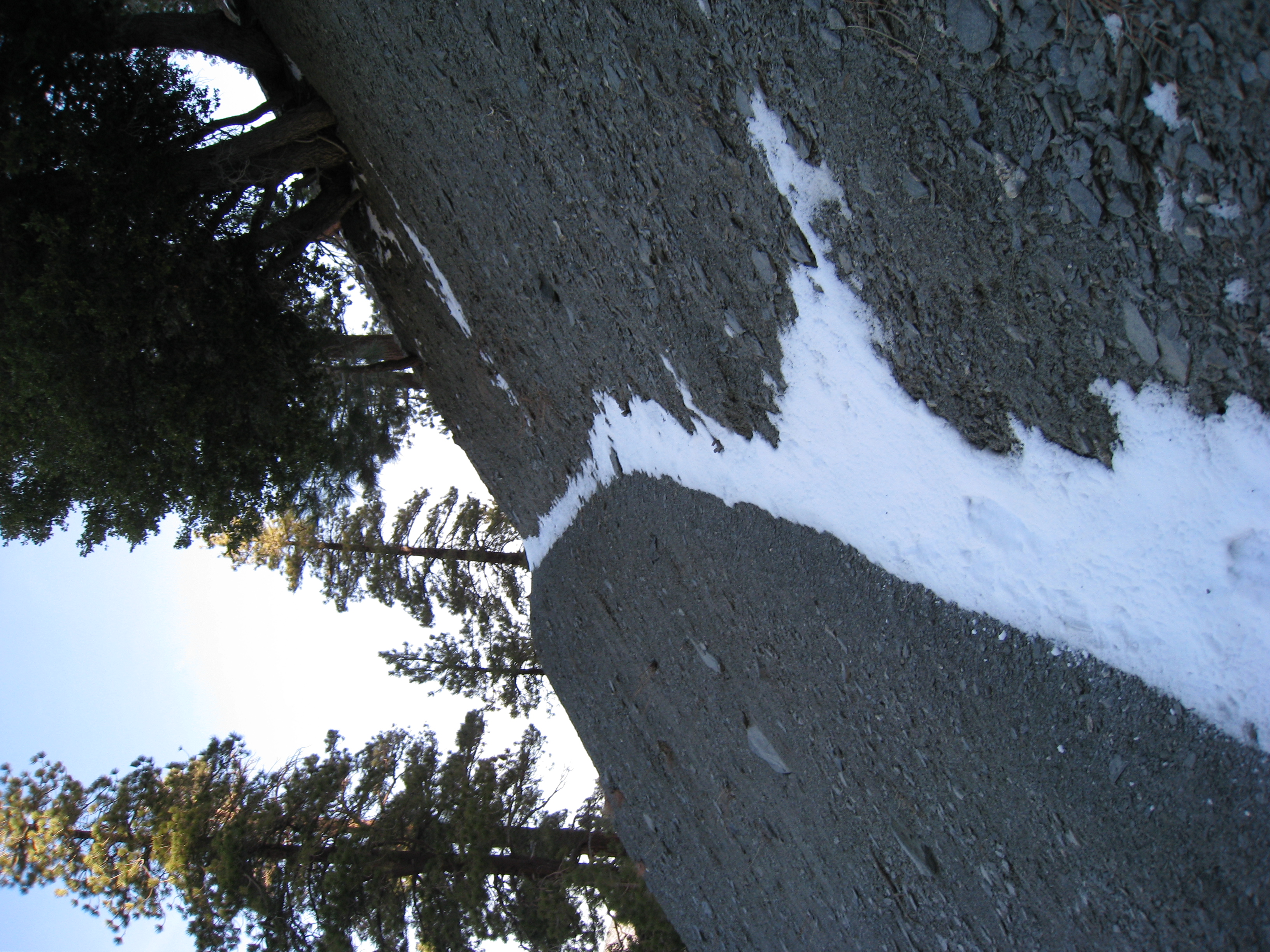
I wasn't sure how much snow there would be on the lower portions of the trail. In fact, I thought I would be making quick time until I hit the snow. Definitely not the case. While there were a few dry spots on the sunny side of the slopes, I was surprised that I was in snow for about 98% of the trip. It ranged from a few inches at the bottom to several feet of powder near the top. And even the dry spots had enough snow that my crampons rarely hit dirt on the way up.
3 
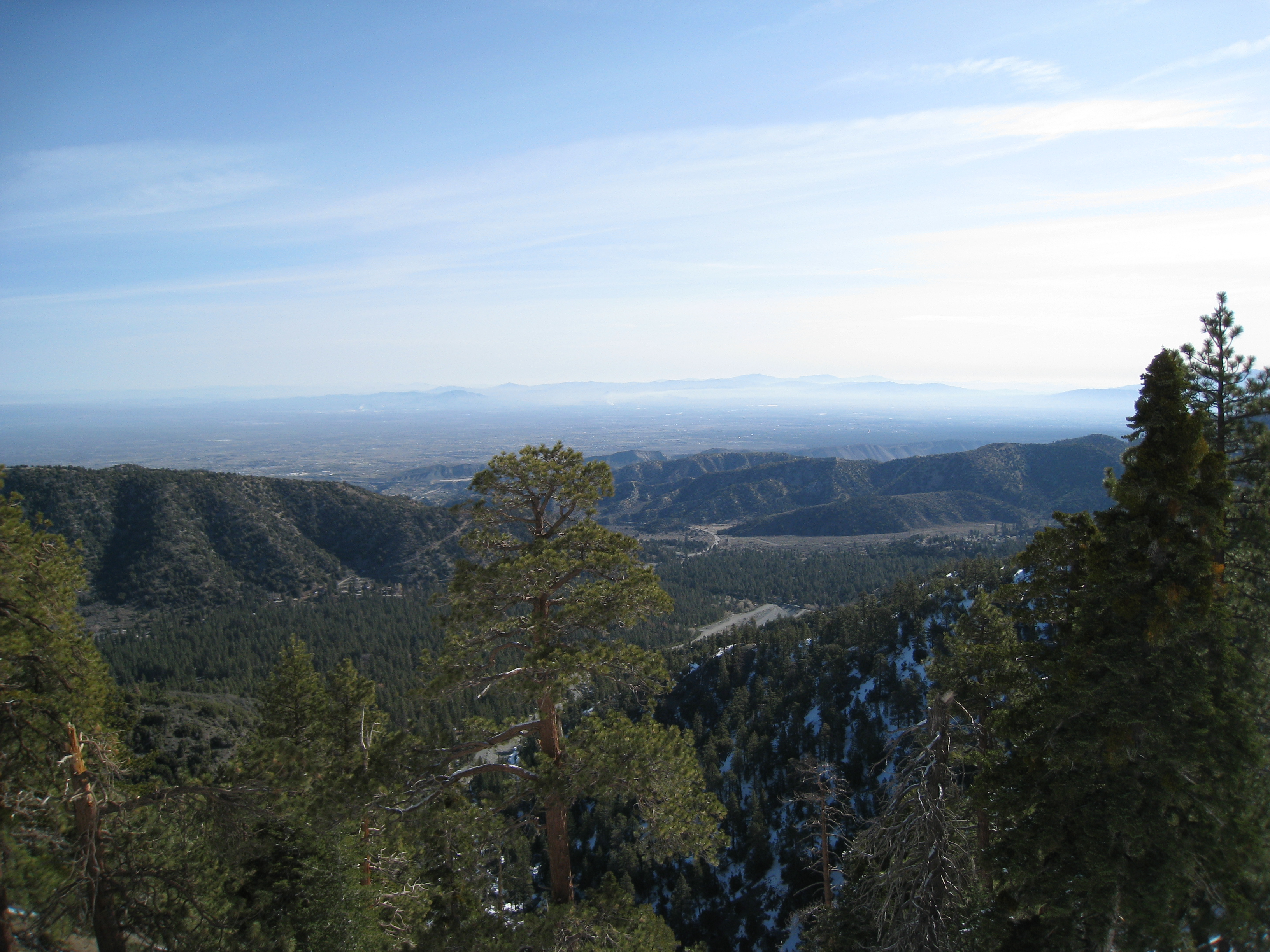
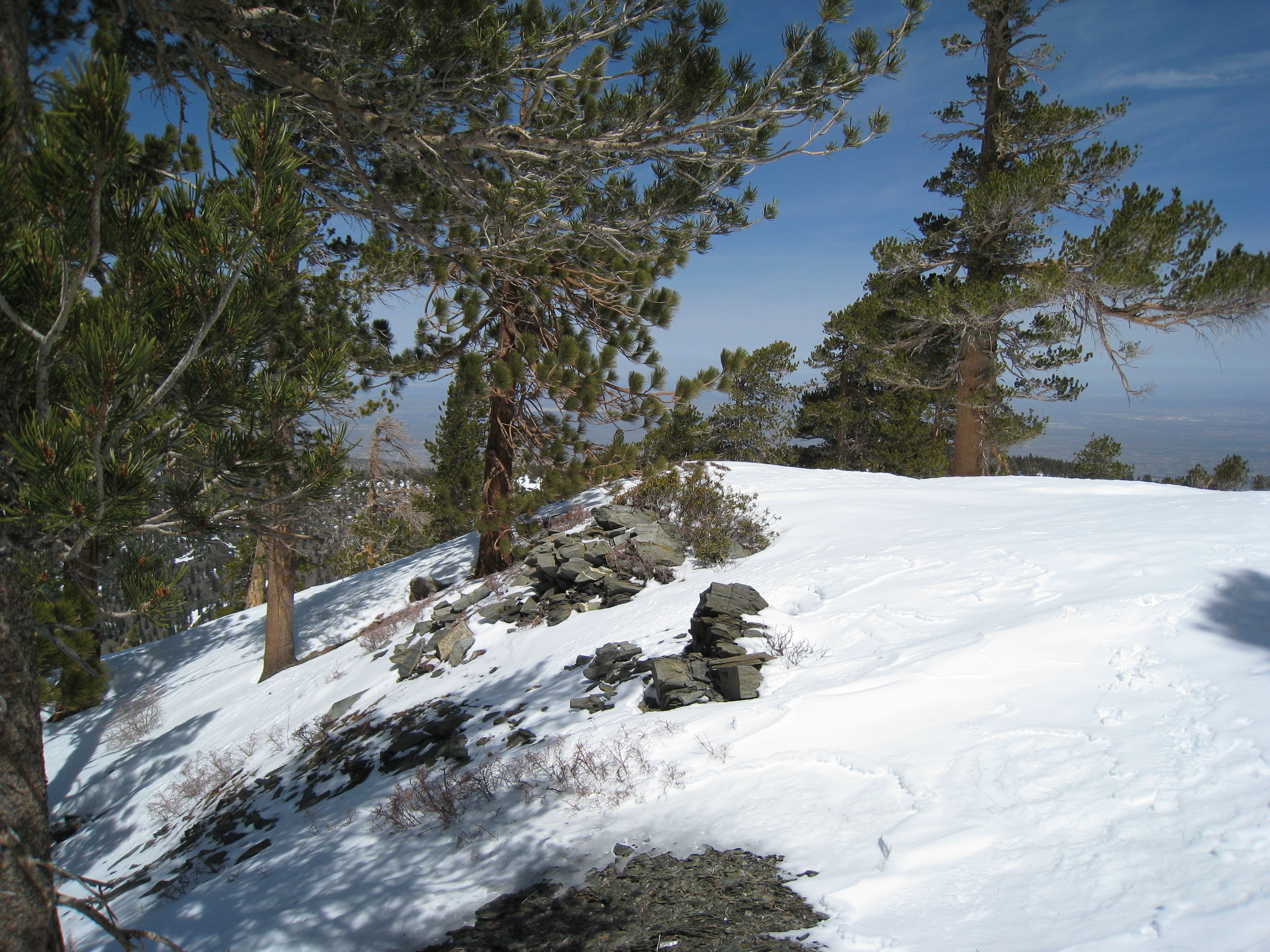
A look at the valley below on the North side of Baldy.
4 
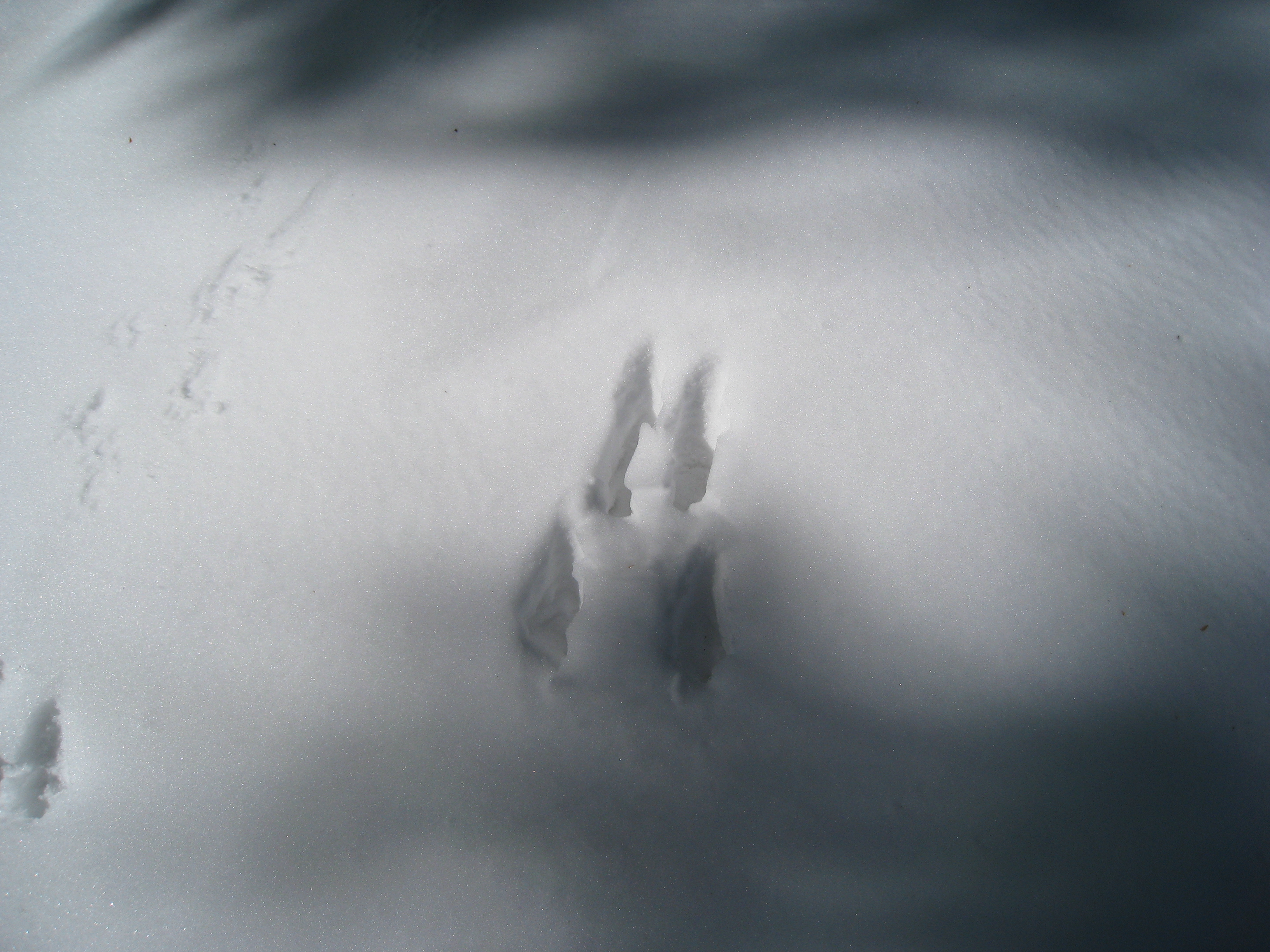
I have still yet to see any large wildlife in the snow, but there sure are a lot of really large tracks. This footprint (deer?) is huge, larger than my fully stretched out hand.
5 
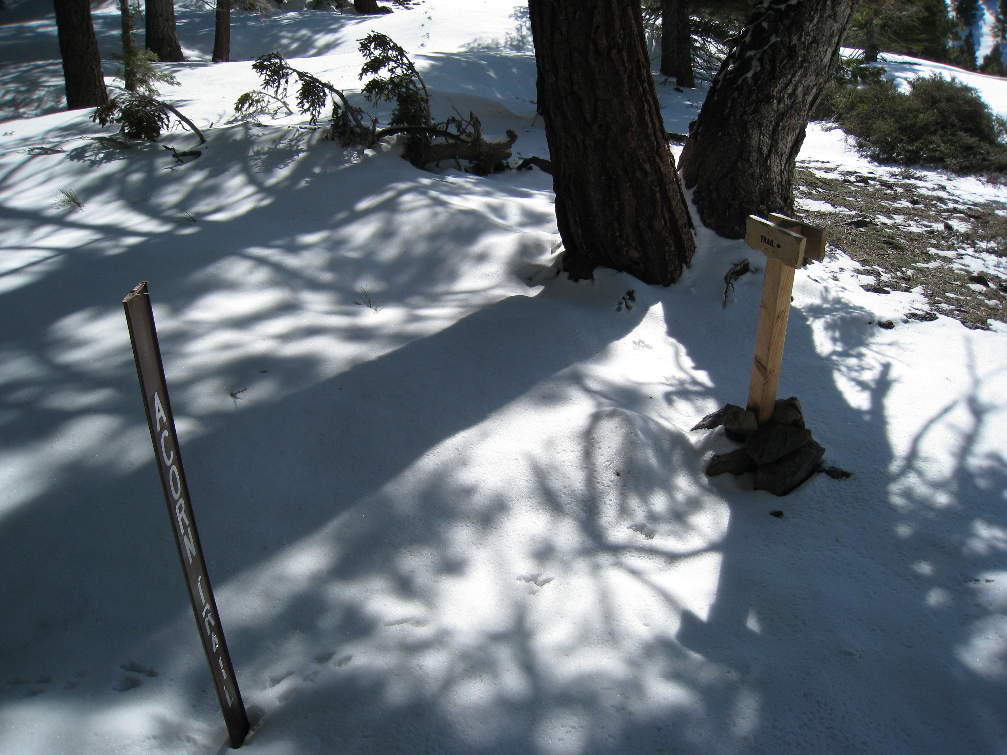
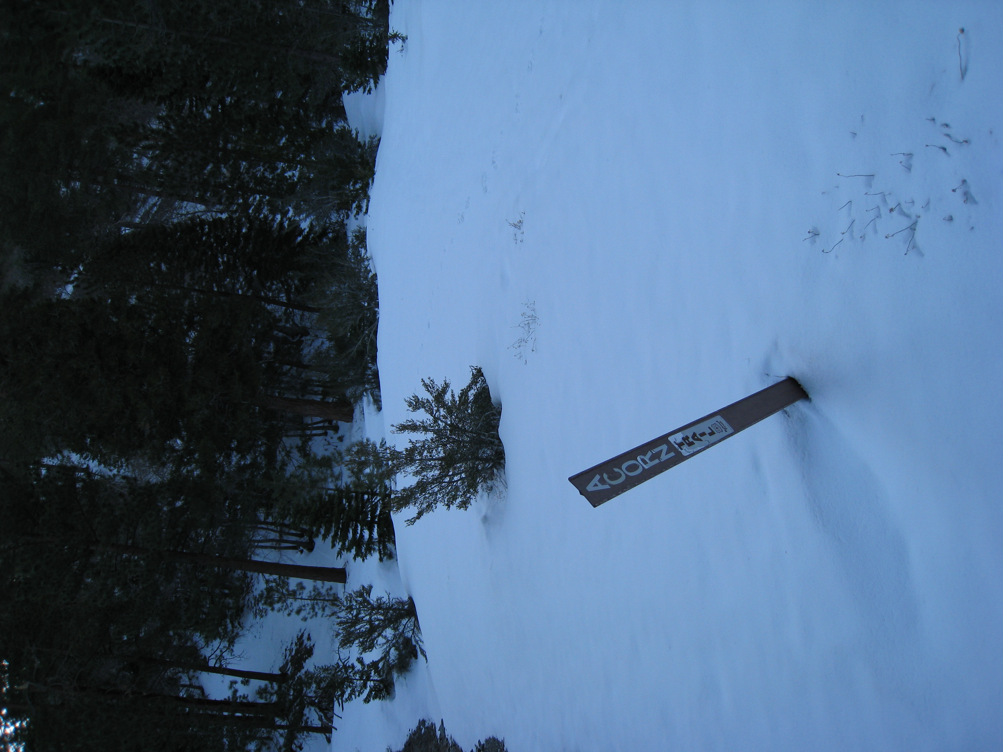
I made it to the top of the Acorn Trail in good time, nearly 30min faster than my previous attempts. This is mostly due to the fact that I am using boots and crampons this trip rather than snowshoes. After comparing the two, I can definitively say that snowshoes are much faster, less work, and more fun in deep powder, but crampons are massively easier, safer, and faster on very steep or technical terrain.
6 
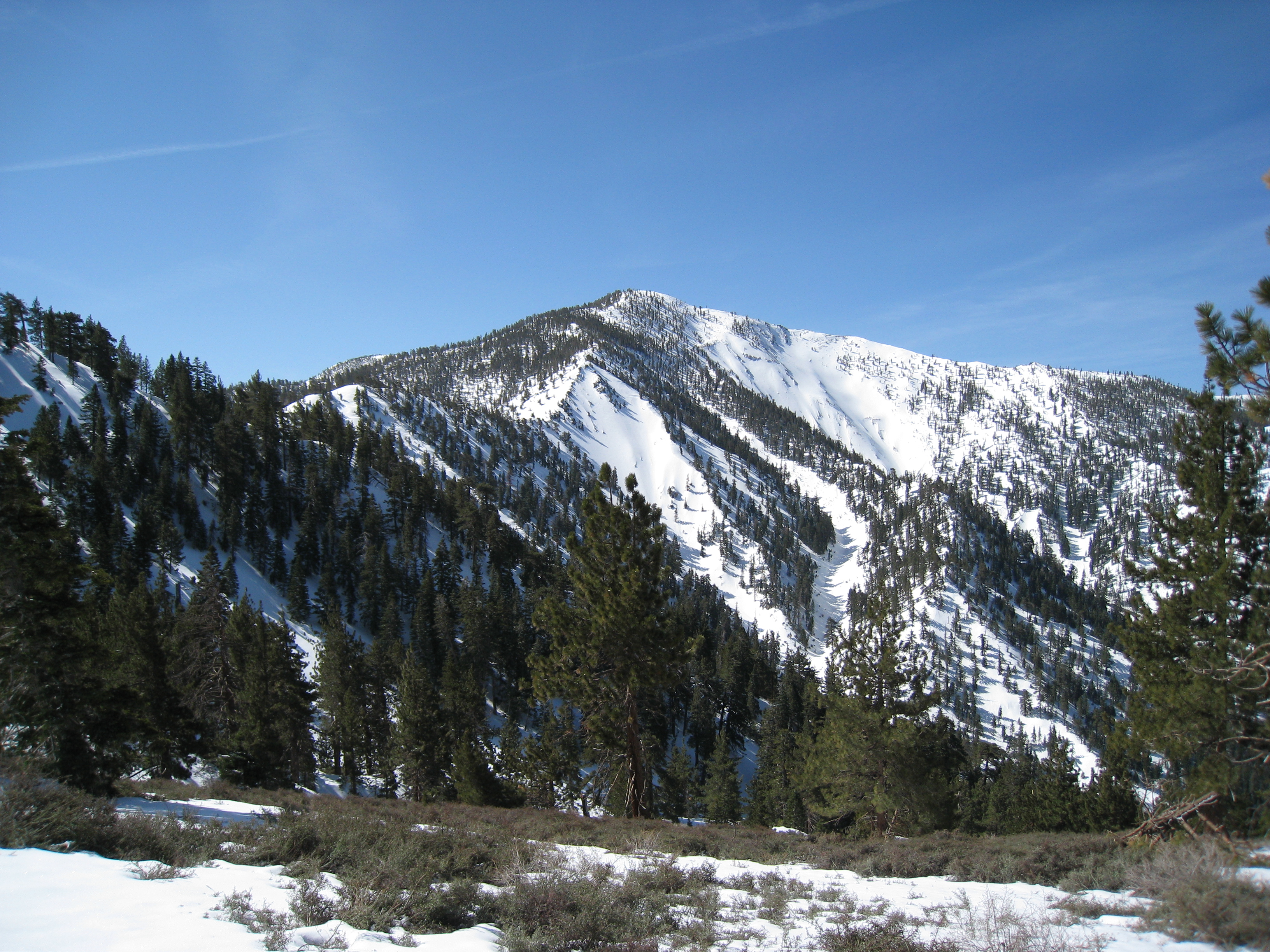
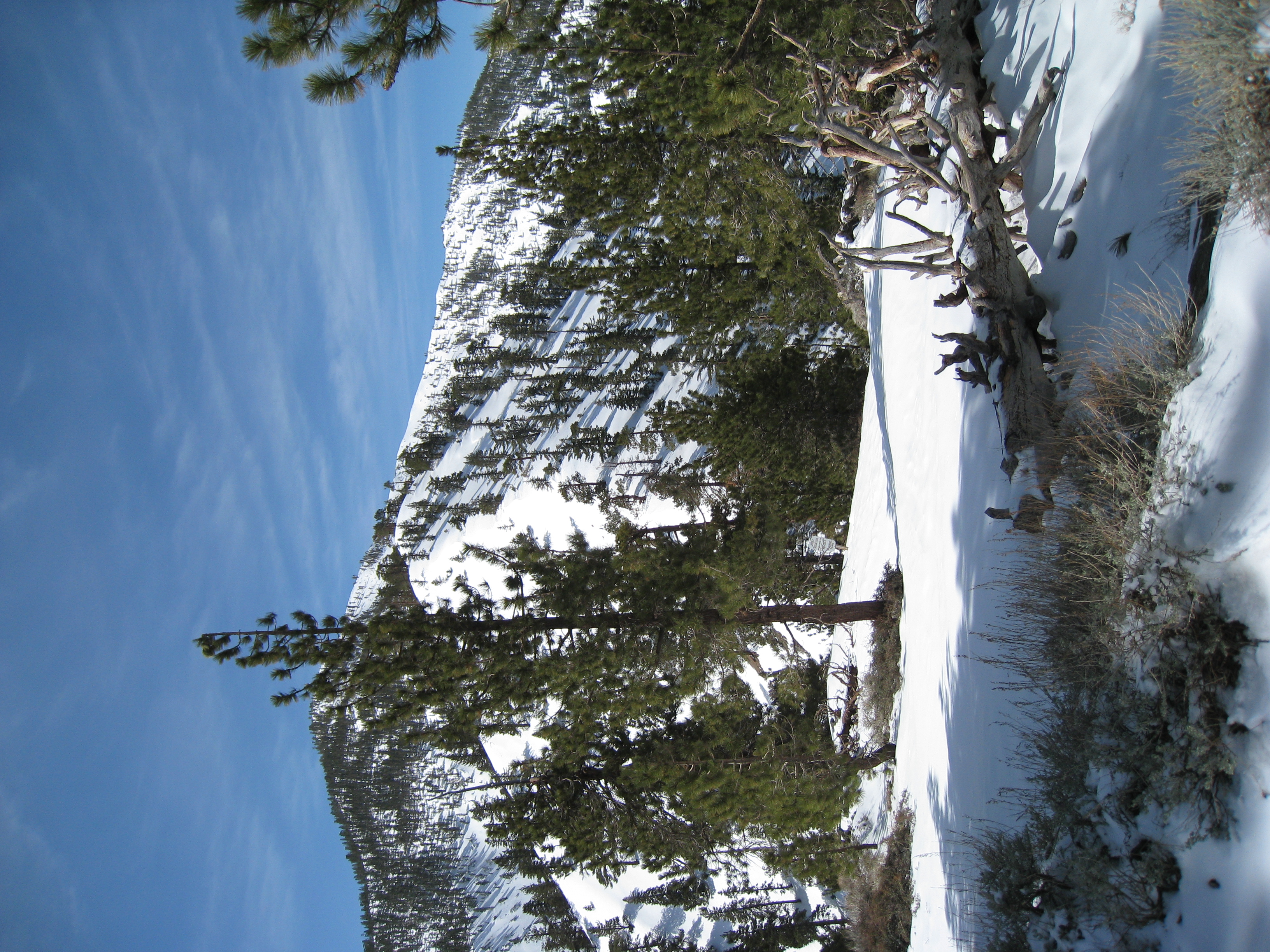
My first look at Pine Mtn. and the Backbone Trail. A brutal but beautiful trail.
7 
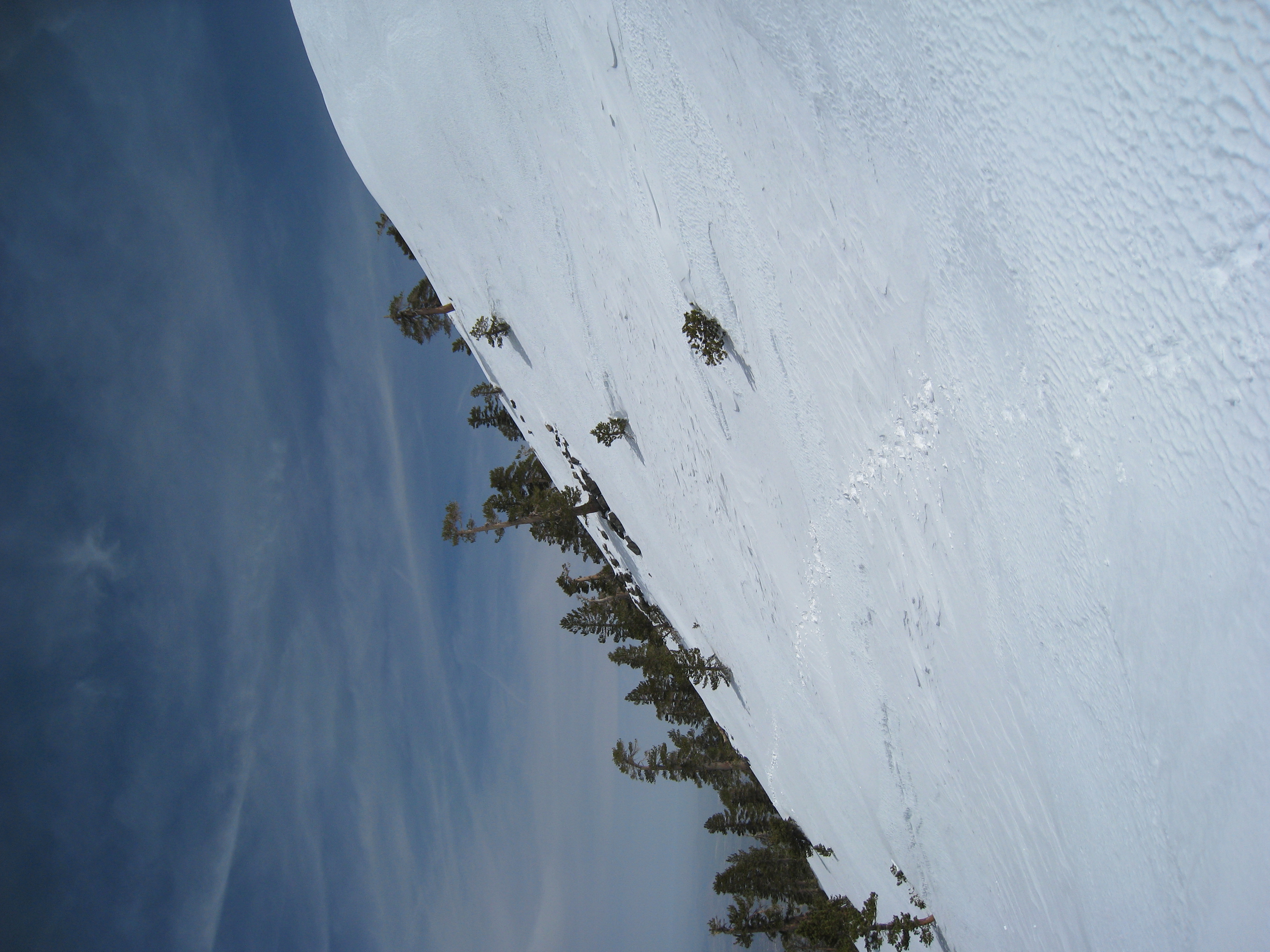
Similar picture as on previous trips. There is easily as much or more snow as last time I was here.
8 
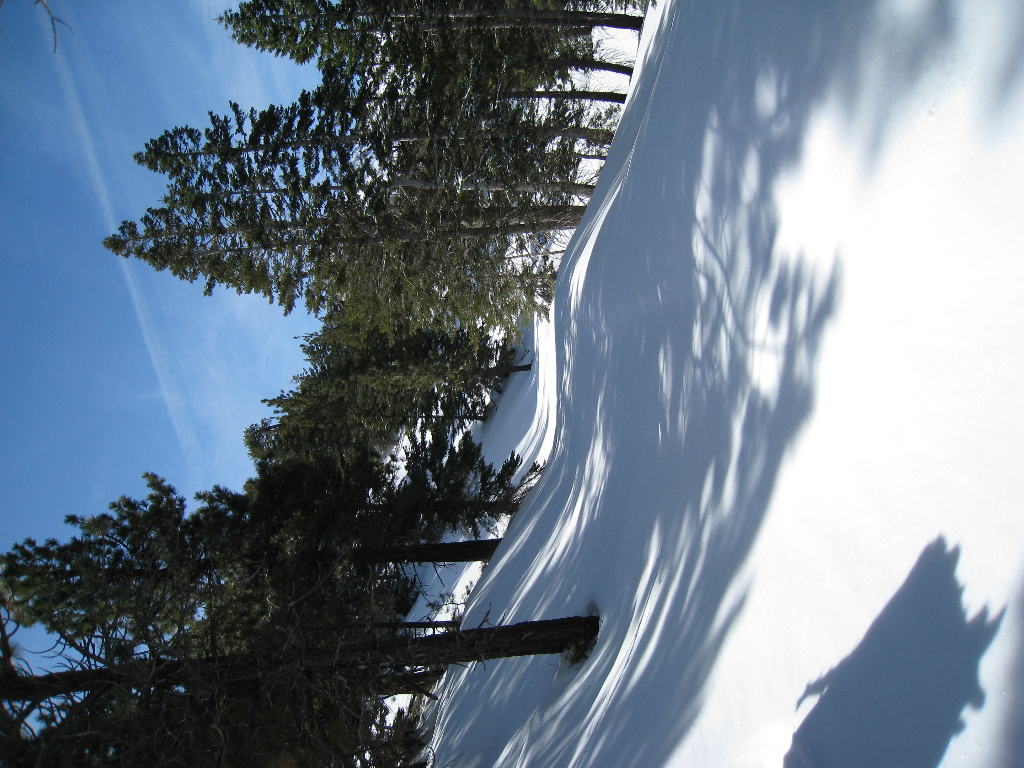
The fire road near the PCT. Like usual, not a single human sighting the entire day. And not a single footprint, which means not a single human on the trail in at least a few days, probably much longer.
9 
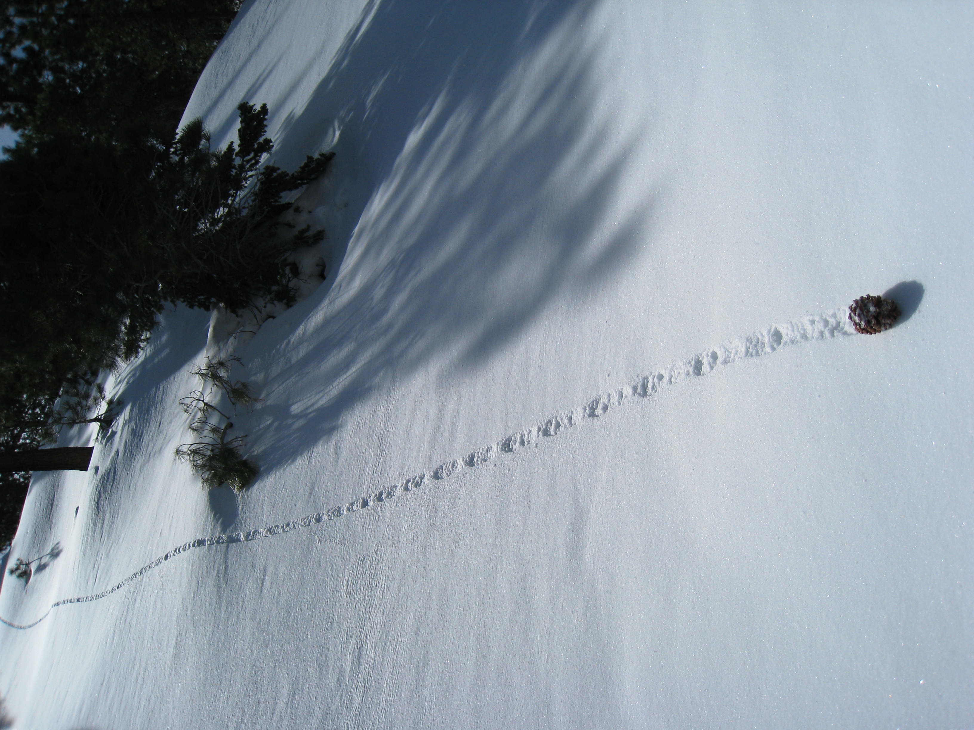
A random, interesting picture of a pine cone rolling down the hill. You know you are in really fresh snow when you see tracks like this.
10 Getting ready to ascend Pine Mtn. via the Backbone Trail. One of my all-time favorite trails.
11 
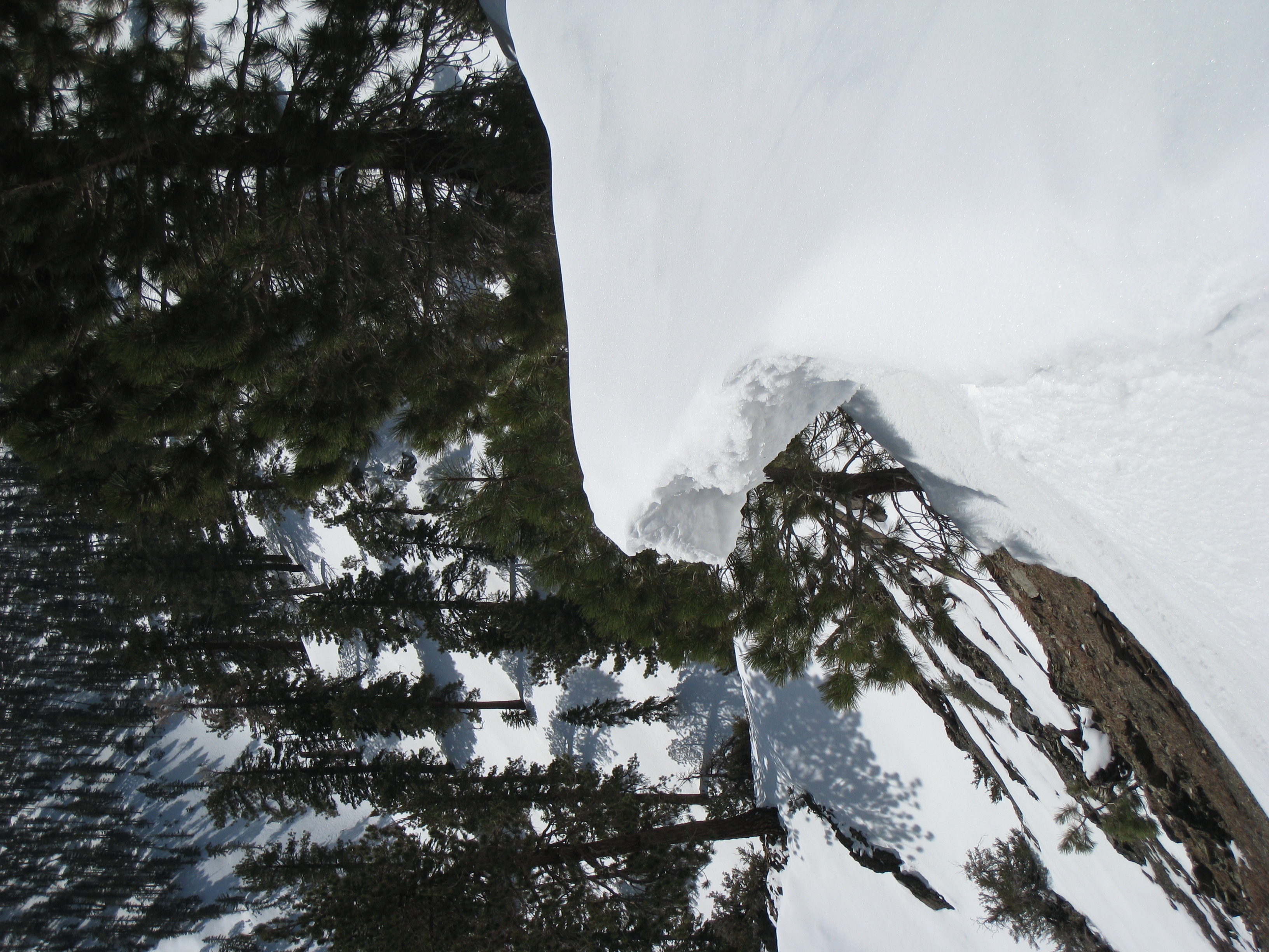
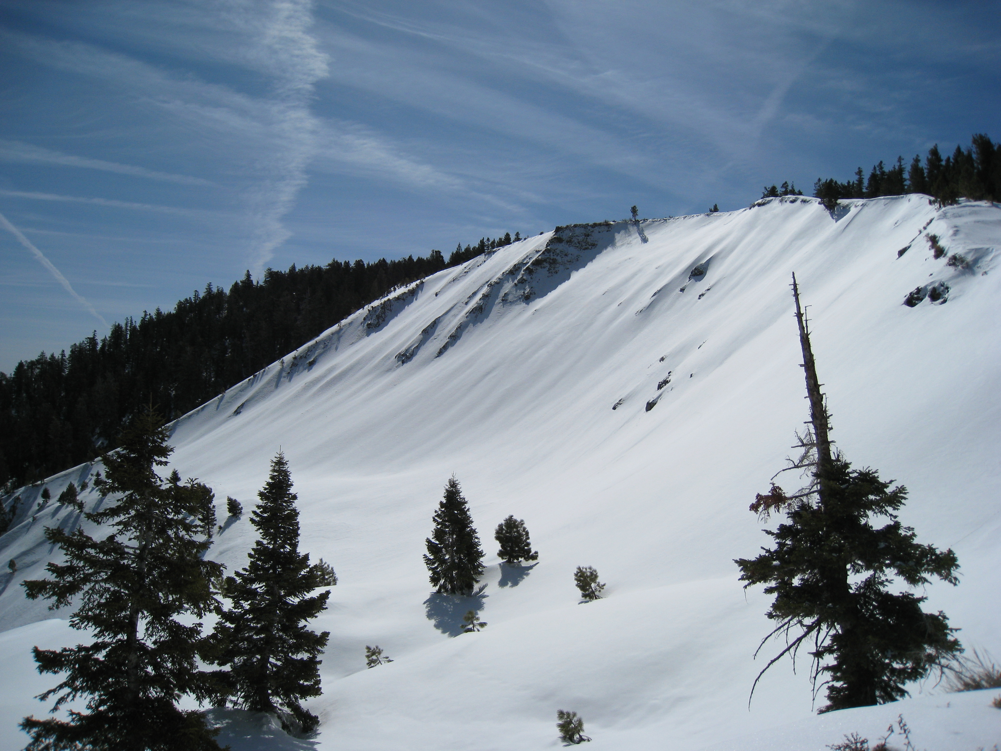
The Backbone Trail traverses across a very narrow ridge and there are large snow/ice overhangs. I am always a bit nervous about walking too close to these. It's a long ways down if they fall off!
12 It always pains me to include this picture, because it has absolutely none of the real life impact of seeing this slope in person. This is an insanely steep section of trail. Imagine hiking something close to the Half Dome cables without the cables. Now imagine doing it in the snow.
13 Made it to the top of Pine Mtn. The rock walls of the backpacker's tent spots are starting to show through the snow. Last time I was here, they were completely covered. Or maybe I never passed this exact spot last time? I am never quite sure without having a trail to follow. This is as far as I made it on my first snow trip up here. And I'm still about a half hour ahead of where I was on that day.
14 A look at my path traversing across a slope with about 50% incline. This would have been -extremely- difficult and very dangerous in snowshoes (if you wipe out, you are going downhill for a long, long ways). Though still difficult, it was much easier and safer in crampons. It is still murder on the ankles, but you definitely have a lot more control. And I am trying a technique where I carry both my trekking poles and ice axe at the same time, which seems to be working pretty well.
15 
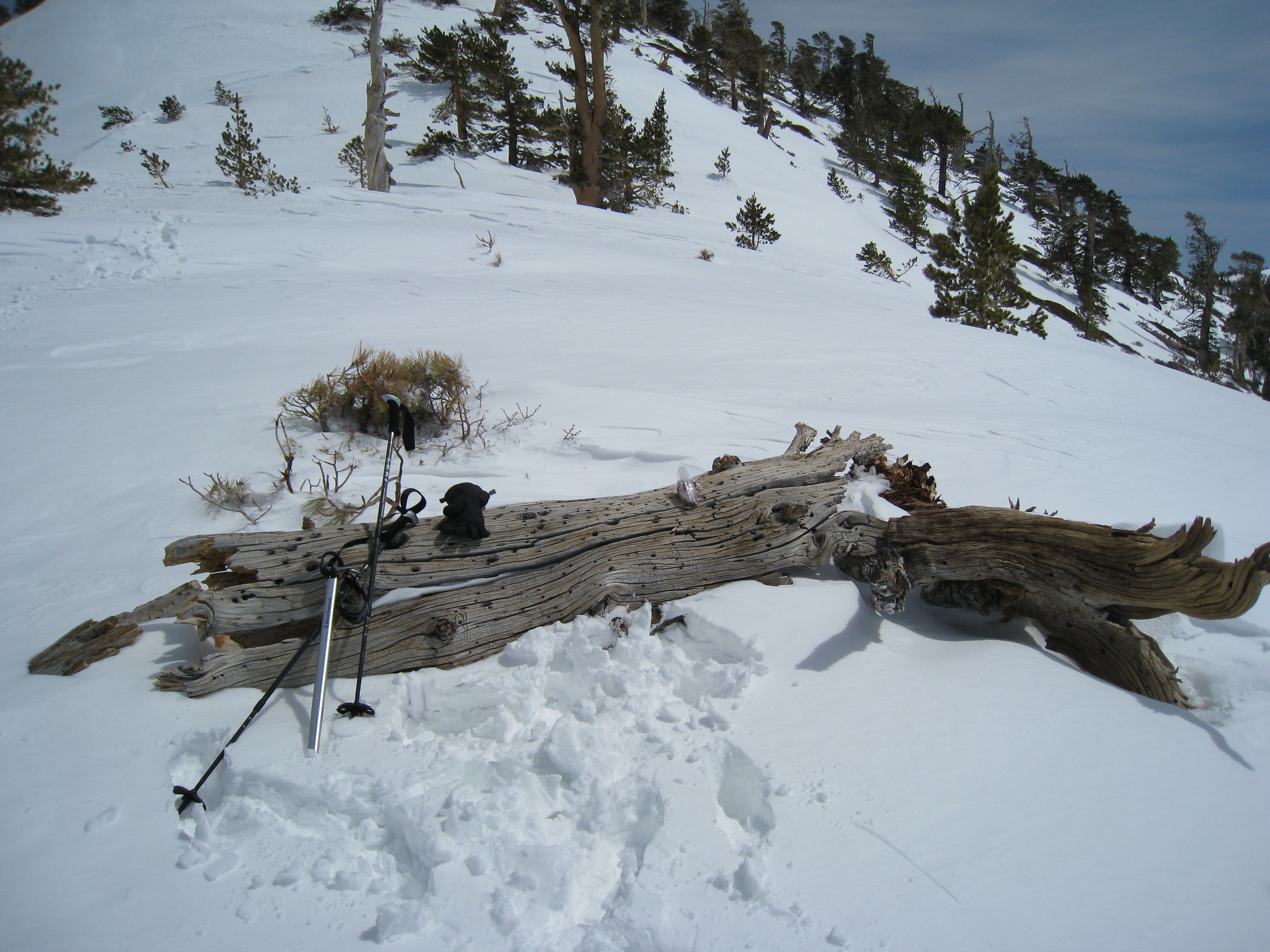
Made it to the spot where I ate lunch last time. I made it here almost a full hour faster than last time. But, it's still 1:30pm and I have a long ways to go to the summit. You can see my trekking poles and ice axe here. This time I actually took full advantage of all three ways to use the ice axe. 1.) Climbing. On the really steep slopes, there are short sections where you have zero traction even with crampons (because of the loose snow). With the ice axe, you swing it deep into the snow and then pull yourself up while your lower body basically crawls up the slope. Effective and fun. 2.) Glissading. On the way down, I was able to glissade on some sections I would have never dared try before. Using the ice axe as a brake and rudder gives you massively more control. 3.) Self arresting. Unfortunately, I really did use the ice axe for this. After a wipe out going downhill, I had that moment of panic where you look downhill and think "how bad could this get?". In this case, it would have been really bad. I managed to get the axe into the slope and slow my fall before things got ugly. My technique was horrible I'm sure, but it worked.
16 
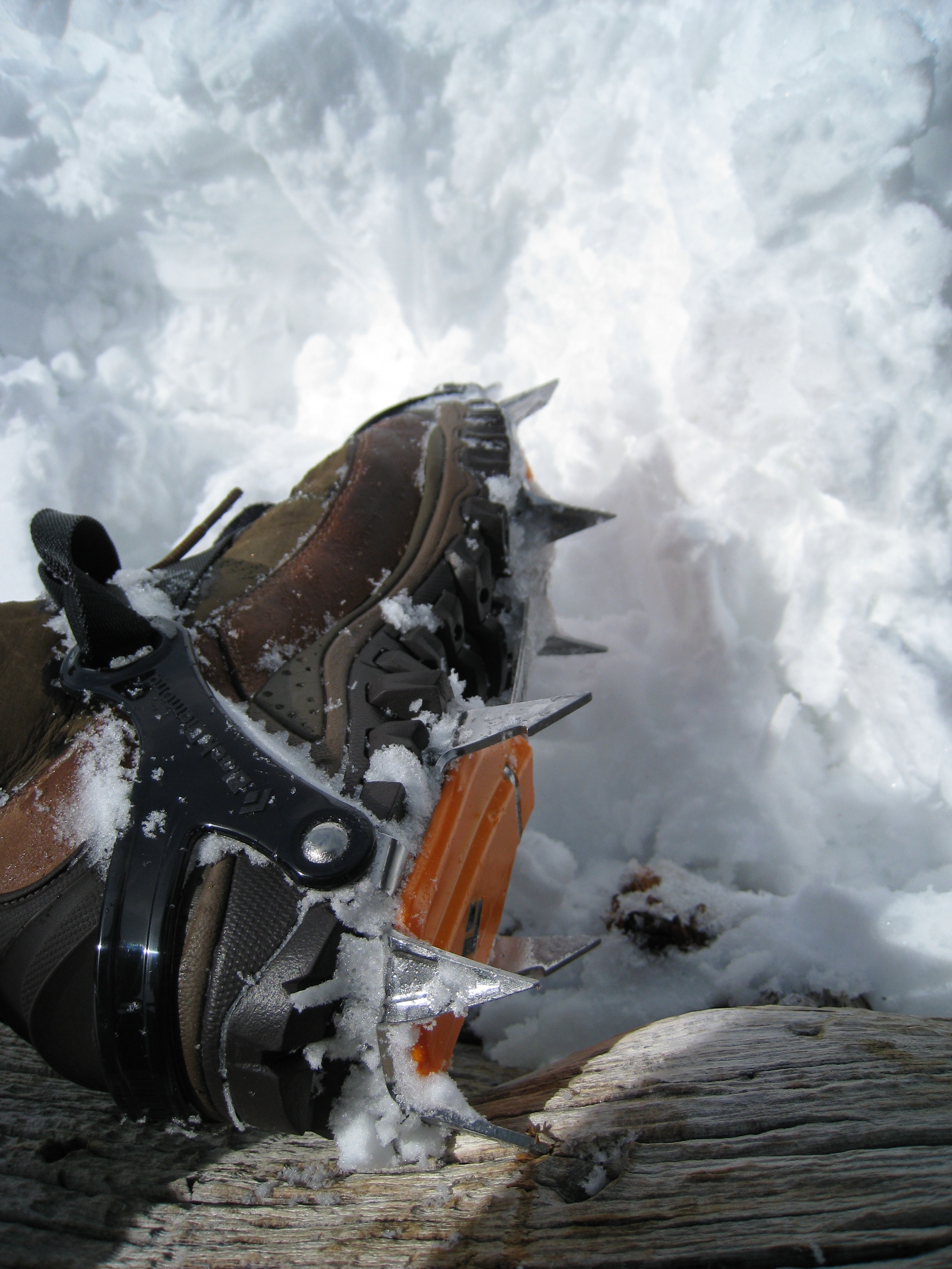
A look at my Black Diamond Contact strap crampons. These are much easier than the step-in kind, because you can use them with any type of shoe. They are stainless steel, with anti-balling plates (to keep snow from getting clogged up on the bottom). You can also see my Merrill snow boots. Waterproof, insulated, with special tread for snow/ice. The crampons performed extremely well, the boots were so-so (but at least I got a great deal on them).
17 
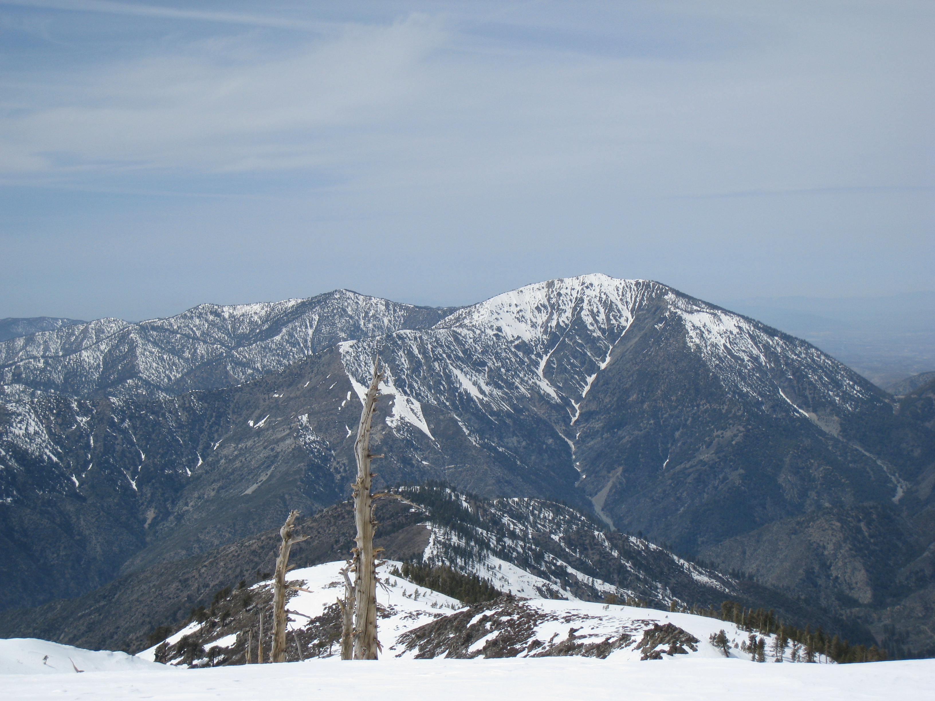
I am embarrassed to say, but in my past photo albums I have said that this peak was Mt. Baldy. This trip, I finally realized this is not Baldy (in fact it's not even close). I begun to wonder after I saw how little snow there was. I'm not exactly sure what peak this really is.
18 This is the peak I couldn't identify on past snow trips. Turns out this is the real Baldy summit. No wonder there is always so much snow there. It looks much closer than the other peak, which (stupidly) increases my confidence that I may summit. At about this time, I realize that my trail map has disappeared! It must have fallen out of my pocket at some point when I was reaching for my camera. I wasted a lot of time here going through my pockets and emptying my entire pack looking for it. Nothing. Fortunately I still have my GPS. It's great for looking at small areas, but it's useless for looking at larger distances. I don't feel good about continuing without a map.
19 
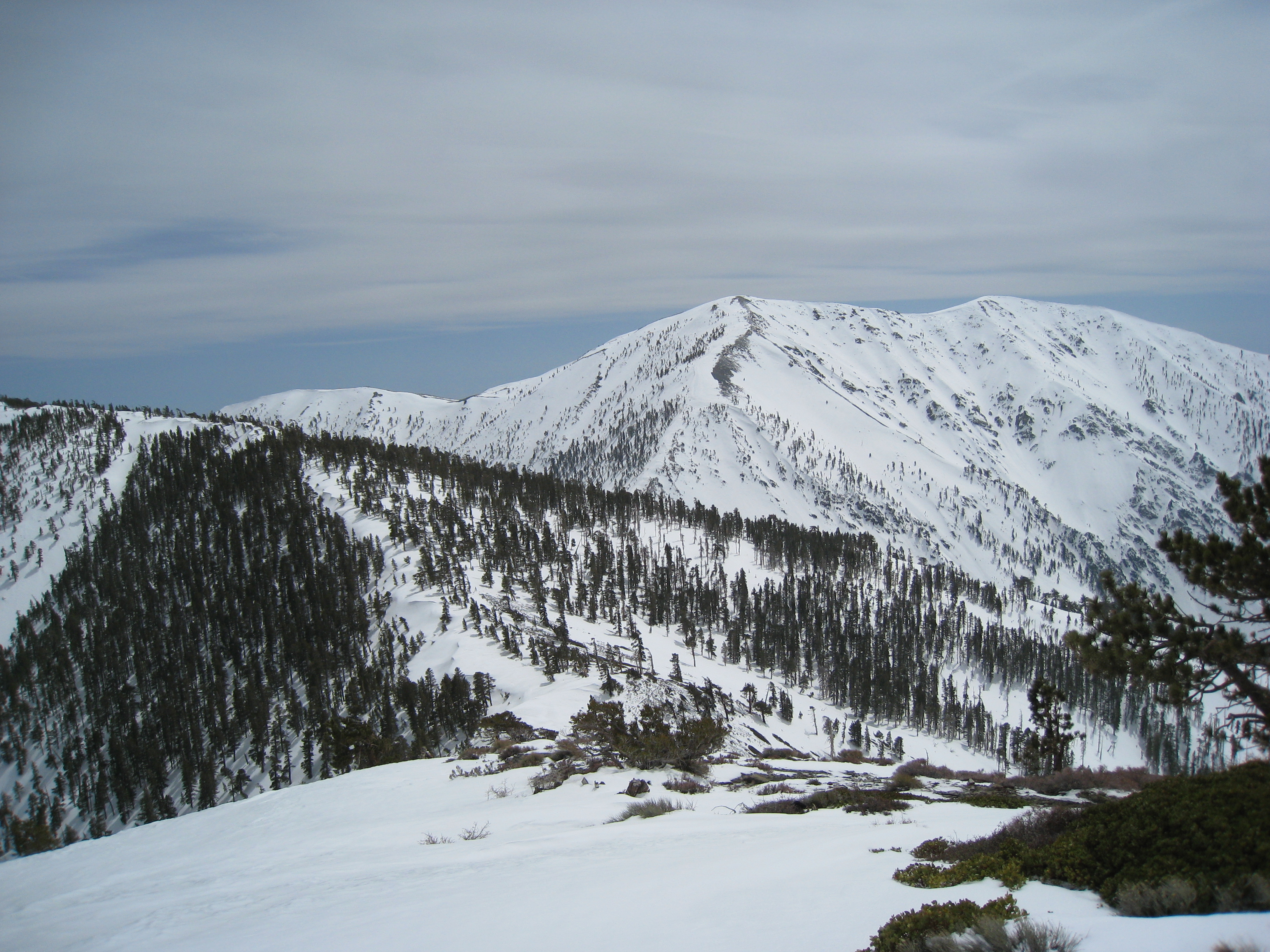
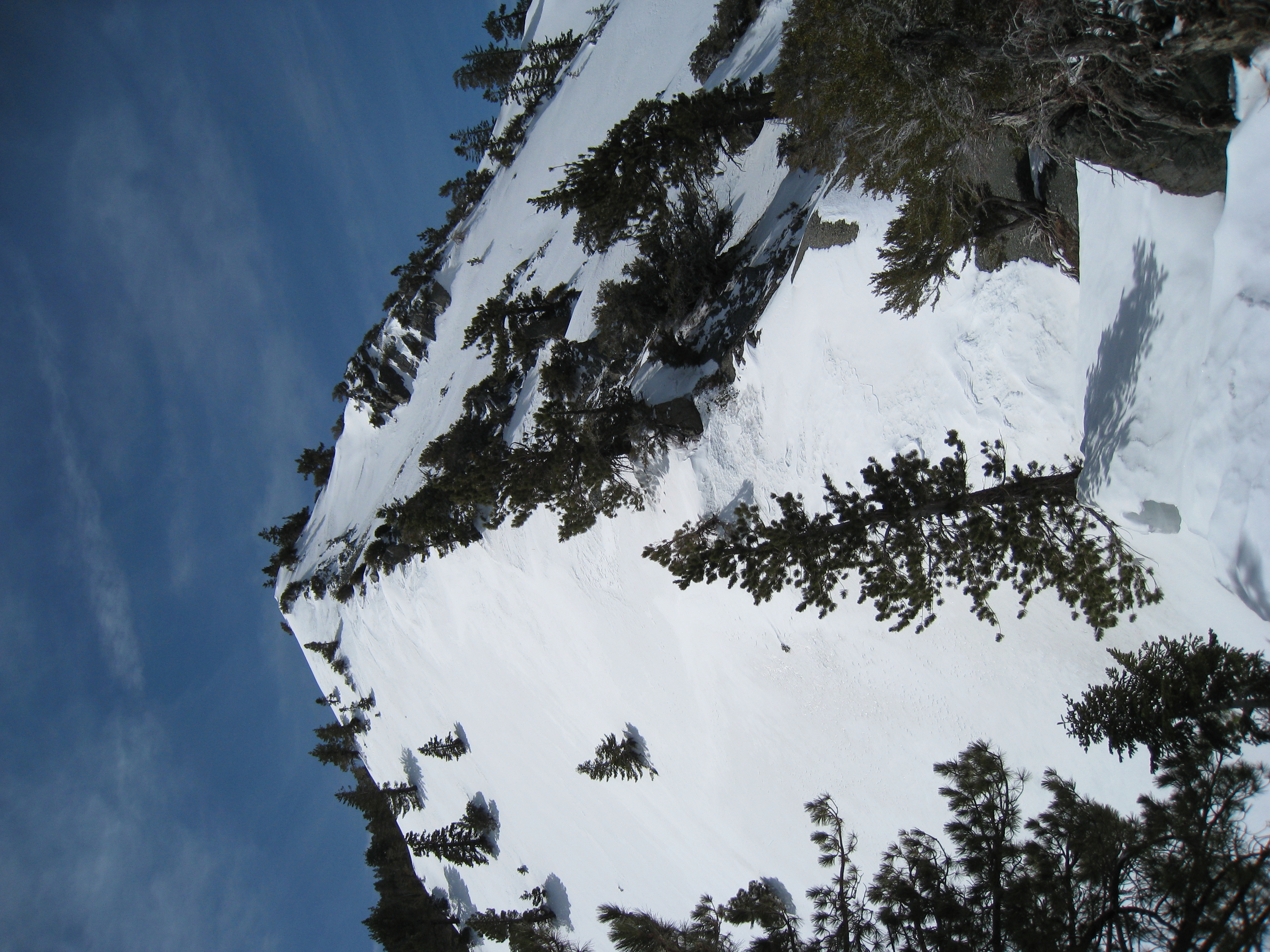
The trail towards the summit. Looks like the summit is just a bit above that ridgeline there. How hard could it be?
20 
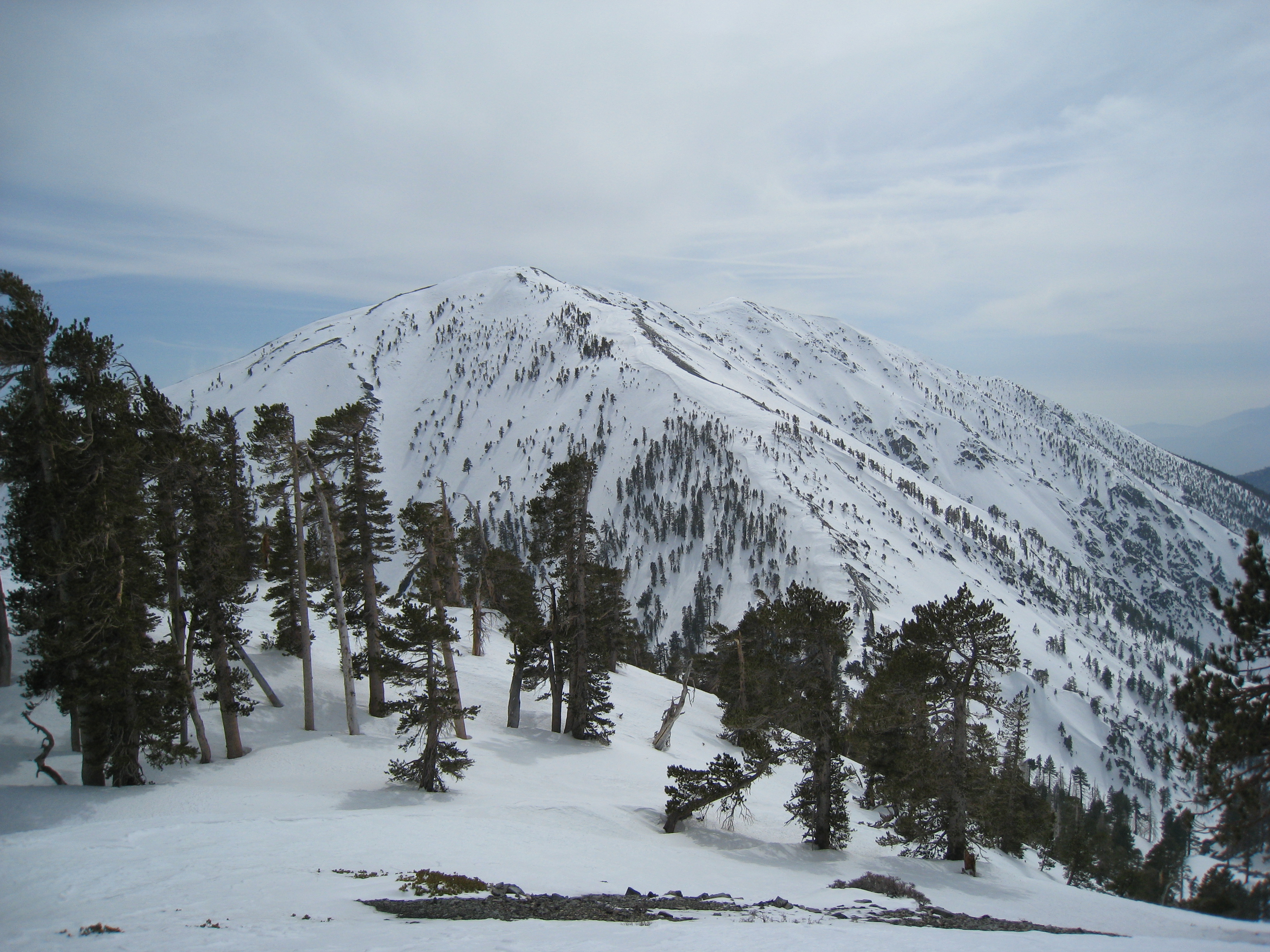
I finally reach that ridgeline, which is Dawson Peak, elevation 9575'. Only 500' below the summit. I'm almost there! Uh, not really. I remember my heartbreak on my first trip here (summer, no snow) when I first looked down into the valley below Dawson Peak. You drop a full 800' down into the valley before climbing 1300' (rather than what looked like 500') to the summit. It is twice as disheartening in the snow.
21 A look at the final couple miles of trail to the summit. The wind is howling now, it's getting cold, and it's getting late. I had decided that 2:00pm would be a nice, safe turn around time, 3:00pm would be really pushing it, and 4:00pm would be stupidity. It's already 3:30pm.
22 Like usual, this picture does not come remotely close to conveying the slope here. This is extremely steep. And the top here is not really the summit, there are a couple more short inclines after that. It's getting really windy and really cold. It's about 4:00pm now. There have only been a couple times so far on my treks where I almost gave up. This was one of them. I was exhausted. And I realized now that I might be coming down in the dark. But there was no way I was getting this close and not summiting.
23 I made it! The summit of Mt. Baldy (Mt. San Antonio). 10,064 feet above sea level. It is 4:30pm. After the excitement of summiting fades, it hits me that I may be in a bit of trouble. It took me a little over 9 hours to get here, and I only have 3 hours until complete darkness. 3:1 time going back might be possible on some trails, but definitely not this one.
24 Another view from the summit.
25 One more view from the summit.
26 The customary 360 video from the summit. Make sure to turn your volume up to get the full effect. When I turned into the wind, I had to fully brace myself with my crampons to keep from blowing over. This was much more satisfying than my San Jacinto snow summit. Much more remote feeling. It really felt like a mini little Everest.
27 The picture says it all. Negative 3.6 degrees Fahrenheit with the wind chill. The temperature was fluctuating between about -2 and -8 degrees depending on the wind. I definitely put my Marmot wind shell to the test. Definitely wouldn't want to stay up here very long.
28 A look at Dawson Peak on the way back. 1300' of treacherous downhill followed by 800' of extremely steep uphill. During that uphill I began to think I might not actually be able to make it back today. I was totally exhausted and almost out of food. That was the hardest 800' of incline I have ever done in my life, bar none. All I could think of was putting one foot in front of the other and hoping the climb would eventually end.
29 This is why you use snow gaiters while wearing crampons! If you happen to slip or stumble (which is frequent in the snow when you're fatigued) and your crampons even slightly graze your other leg, your pants, socks, shoes, and skin are in trouble. Here you see the gaping hole in my now ruined $100 pair of wind shell pants. By the end of the trip, the tear would be up to the knee. I also put a hole in my sock and in my boot. I will never forget my gaiters again!
30 Sunset is nearing and a misty fog starts to settle into the valleys between the peaks. The scenery is absolutely stunning. I wish I wasn't in such a hurry to get down so I could enjoy it more.
31 There were a few times around sunset when I would turn a corner and see a new view and just say out loud "are you kidding me?" The views with the sunset, mist, and snow were just jaw dropping. Some people probably go an entire lifetime without having a chance to see things like this. Like they say, the best things in life you have to work for. And I worked pretty damn hard today.
32 The sun shining low through the forest. Shadows are getting long. Fortunately I'm able to follow my tracks back pretty easily here.
33 Another sunset shot. The orange sky was amazing. Unfortunately, it is now after 7:00pm and I have a long ways yet to go. I had told friends and family I would be down by 7:30pm and I knew I wouldn't be close to that. How could I let them know I was OK before they called in the troops? I have zero cell phone coverage here. My only hope was to make it back to the fire road by 7:30 and hope for cell coverage there. Fortunately I did make it back to that point not too far past 7:30, and I did manage to get a couple txt messages out. I put on my headlamp and prepared to keep trekking in the dark. I am now completely out of food except for a few more gel blocks, which I am entirely sick of by now. In fact, for some reason I'm starting to feel a bit sick to my stomach (dehydration? not enough food? don't know).
34 This is what my life looked like for over 3 hours. Complete pitch black with a beam of light from my headlamp. Fortunately I have backup batteries for the headlamp. But it occurs to me, how do you change batteries if you have no light? Hopefully I will be able to tell when it gets close to dying. My goal was to follow my tracks all the way down. There were also a couple other pairs of tracks towards the bottom. Unfortunately, I lost my tracks with a couple miles to go. I figured I would follow someone else's since they must all eventually get back to Wrightwood. But after a while, and after checking in with the GPS, I realized I was going to end up a long ways from my car. So, I decided to get back to the actual trail. I ended-up spending an hour wandering through dense forest, with no tracks, in complete darkness, trying to get back to the trail. Eventually I found it.
35 Back to the trailhead at last! For some reason, walking through the forest in darkness doesn't bother me too much as long as I'm moving. But when I stopped to take off my crampons, I was definitely looking over my shoulder every time I heard a sound. People were txt'ing me now, and the vibration of my phone sounded like some distant owl or something, which scared the crap out of me the first time I heard it. Now it was just a matter of getting back to my car in Wrightwood. Even that turned out to be no easy task. There are no street lights in Wrightwood, and I took a couple wrong turns before finally finding my car. 10:37pm. 15 and a half hours since I left. Time to let everyone know I'm OK and then find food!