11/24/10 I had been wanting to do the famous Cactus to Clouds trail before the first snow hit this Fall, but I missed out by a couple weekends. So, I decided to do an exploratory scouting trip. Definitely an amazing day. 8500' of elevation gain in 11 miles, hiking from desert sand to alpine snow. I foresee many more adventures on this trail in the future.
1 
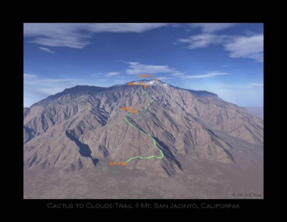
A computerized look at the Cactus to Clouds route to the top of Mt. San Jacinto. People literally come from around the world to do this trail. It is the steepest day hike in the country and is ranked by Backpacker.com as the 5th overall toughest hike in the United States (Mt. Whitney doesn't even make the Top 10).
2 
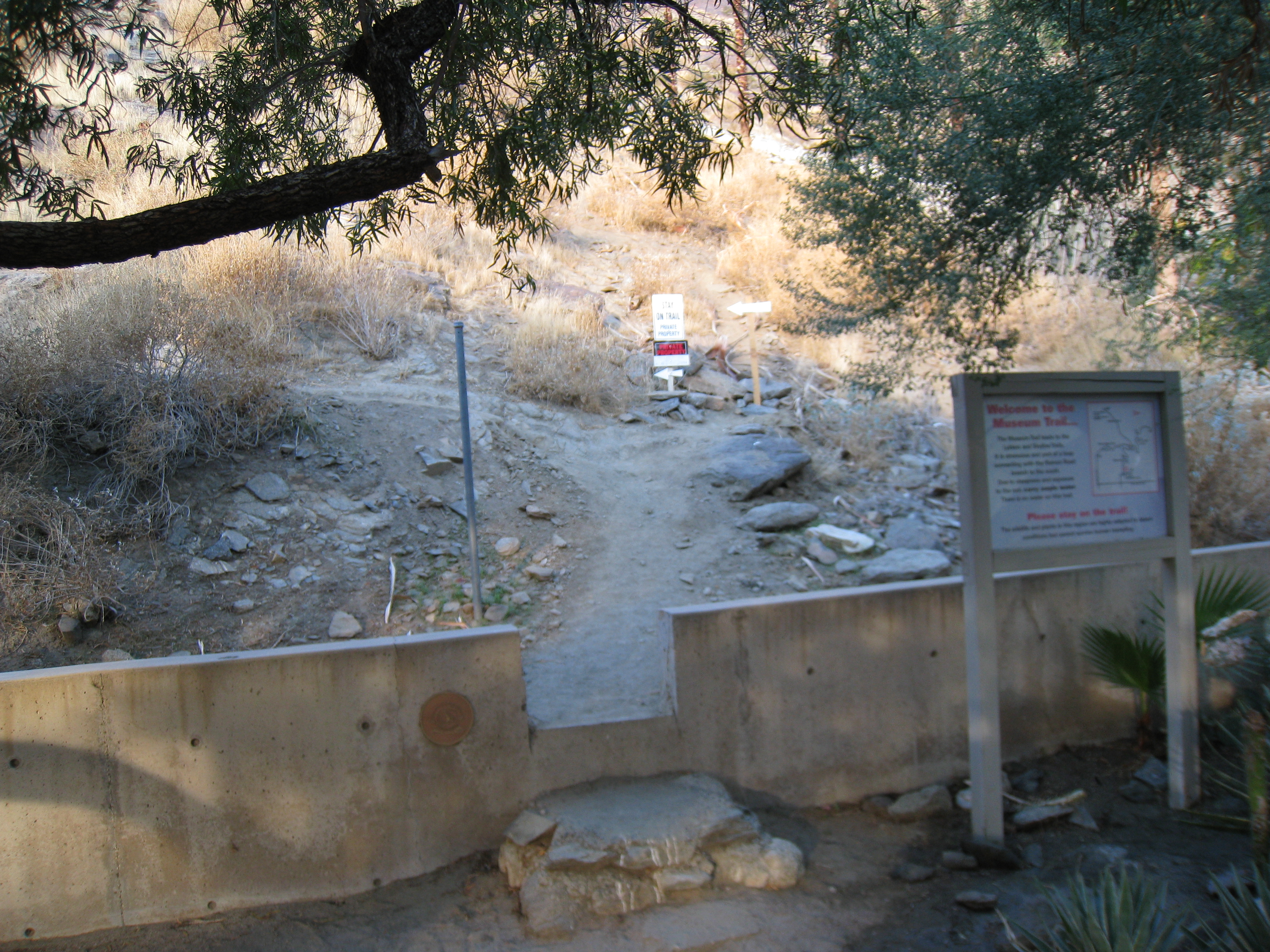
The trailhead at the Palm Springs Desert Art Museum. Easy access, easy to find. The parking lot sign says "patrons only", so I decided not to take any chances and parked across the street. I hit the trail at just after 7:30am. Any plans to do the full route require being here well before sunrise, but today is only an exploratory trip.
3 
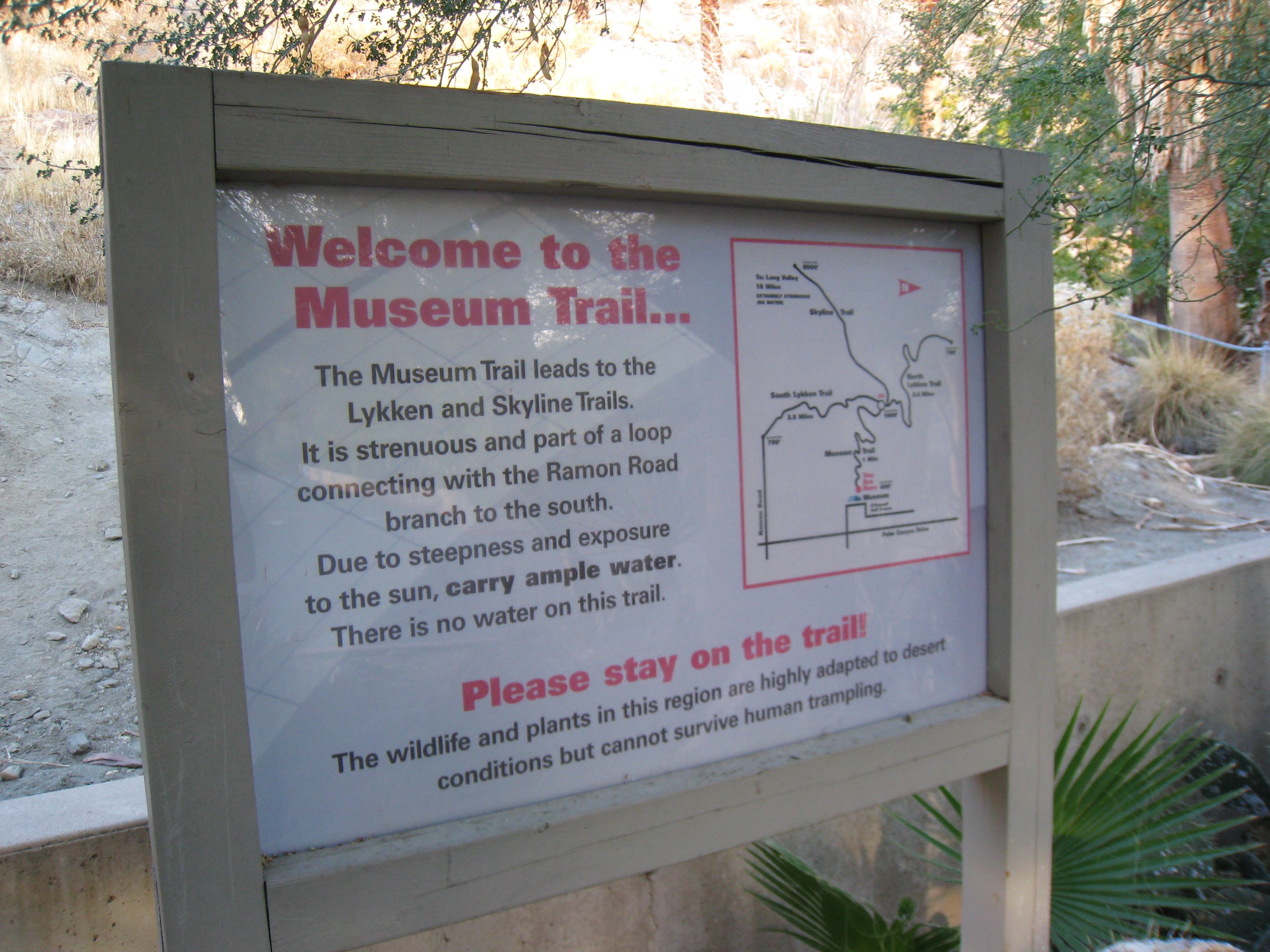
The route starts on the Museum Trail, a short but steep loop that joins with the Skyline trail a bit over a mile up. My plan for the day was to just hike up until I hit the snow line and then come back.
4 
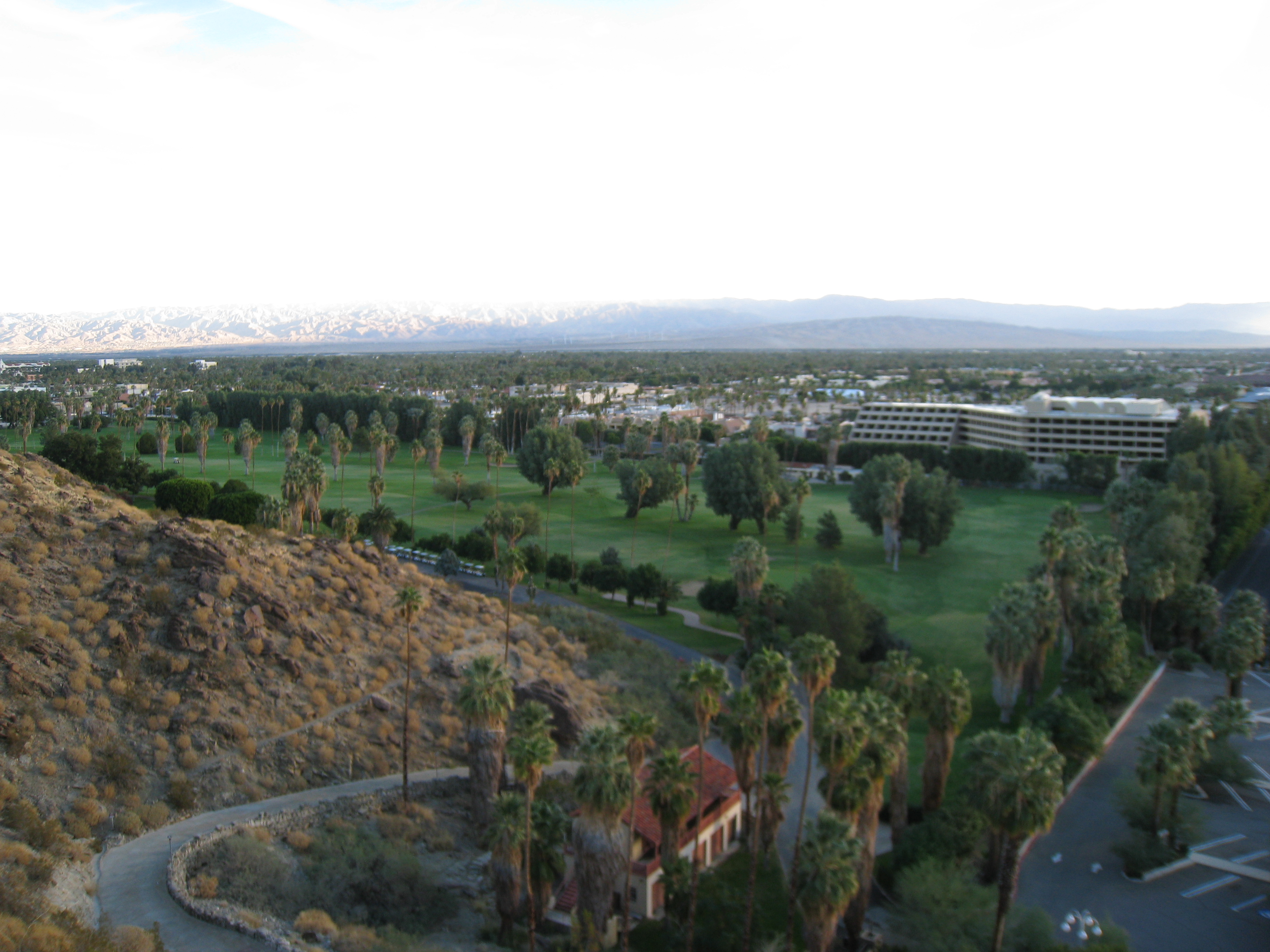
Leaving the watered lawns of Palm Springs.
5 
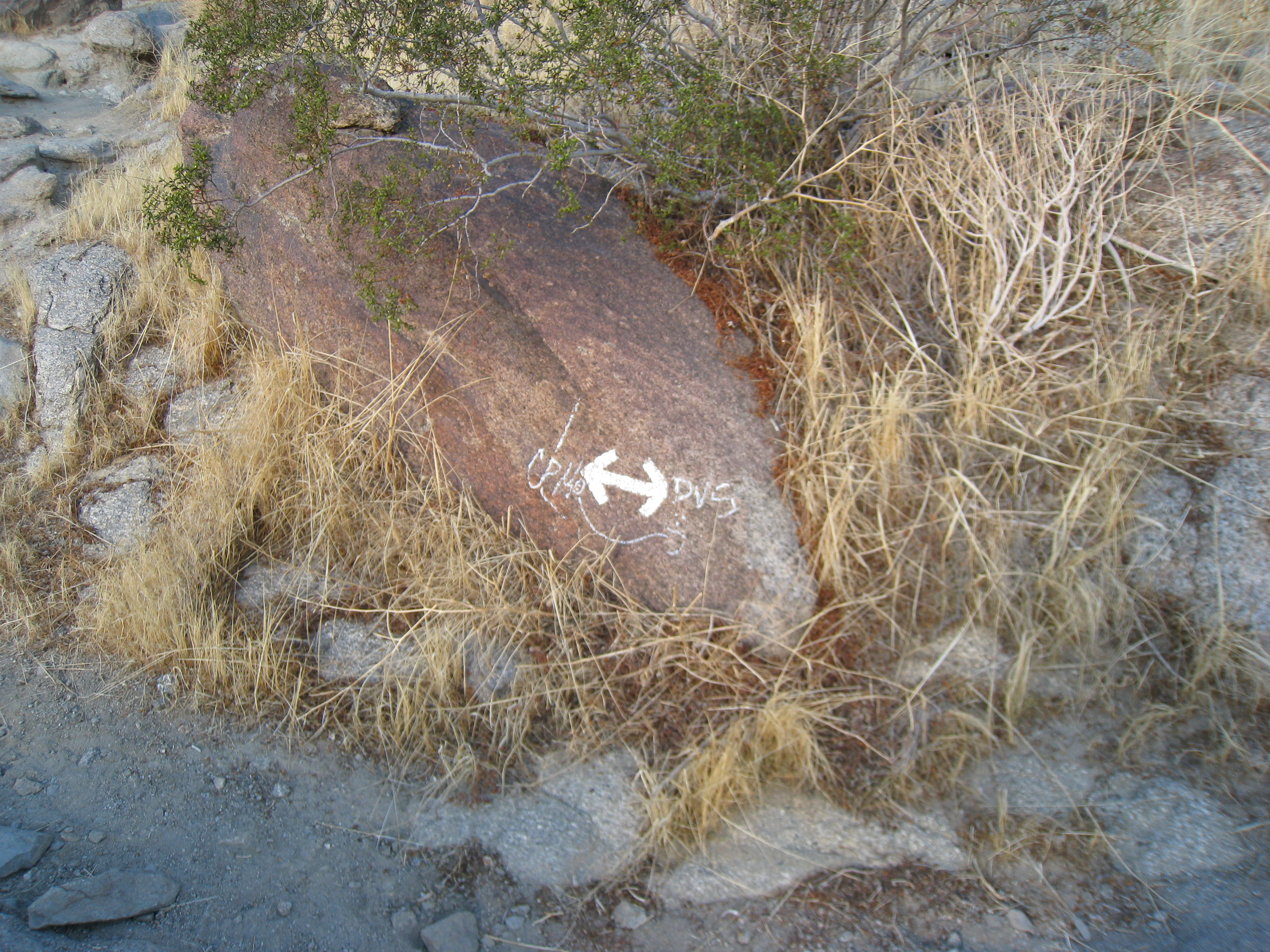
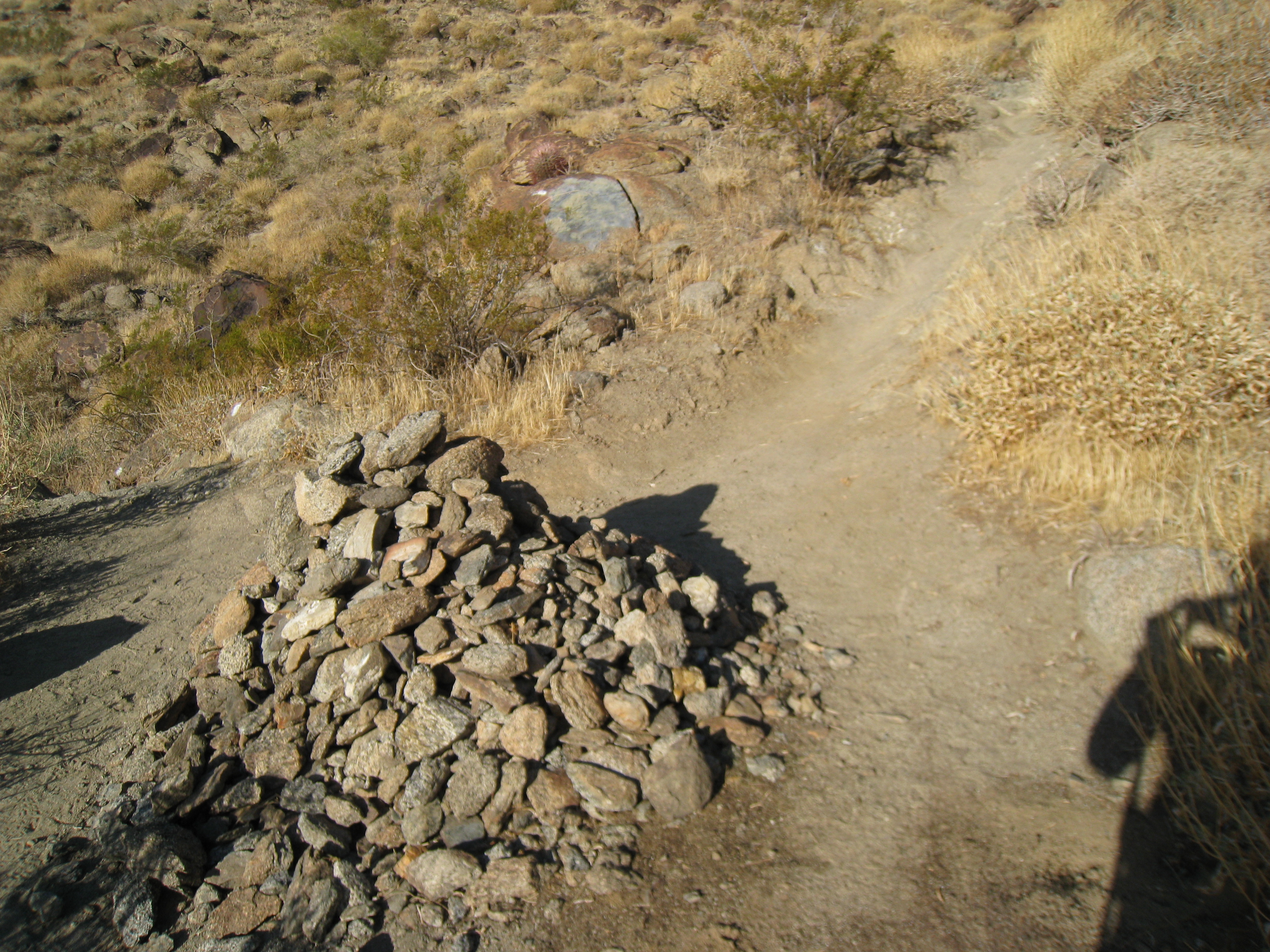
Trail markings. There are no published maps of the Cactus to Clouds route and it is not maintained. But there is enough use that of it that it's pretty easy to follow. I'm sure these trail marking have some technical meaning that I haven't learned yet.
6 
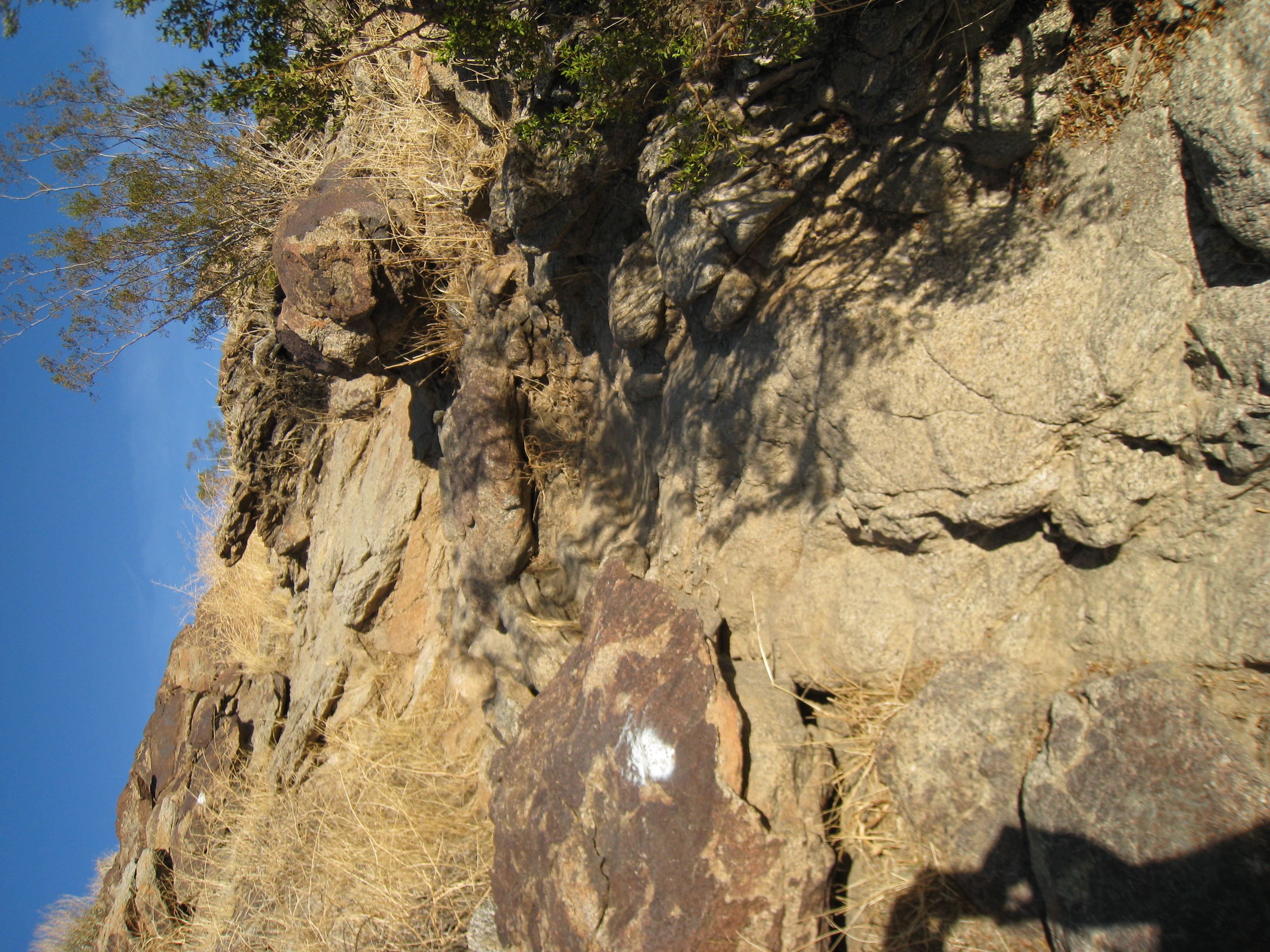
A typical portion of the Museum trail. Steep, technical, and marked by white paint. Awesome.
7 A rest area where the Museum trail joins with a trail coming from the other trailhead at Ramon Road.
8 
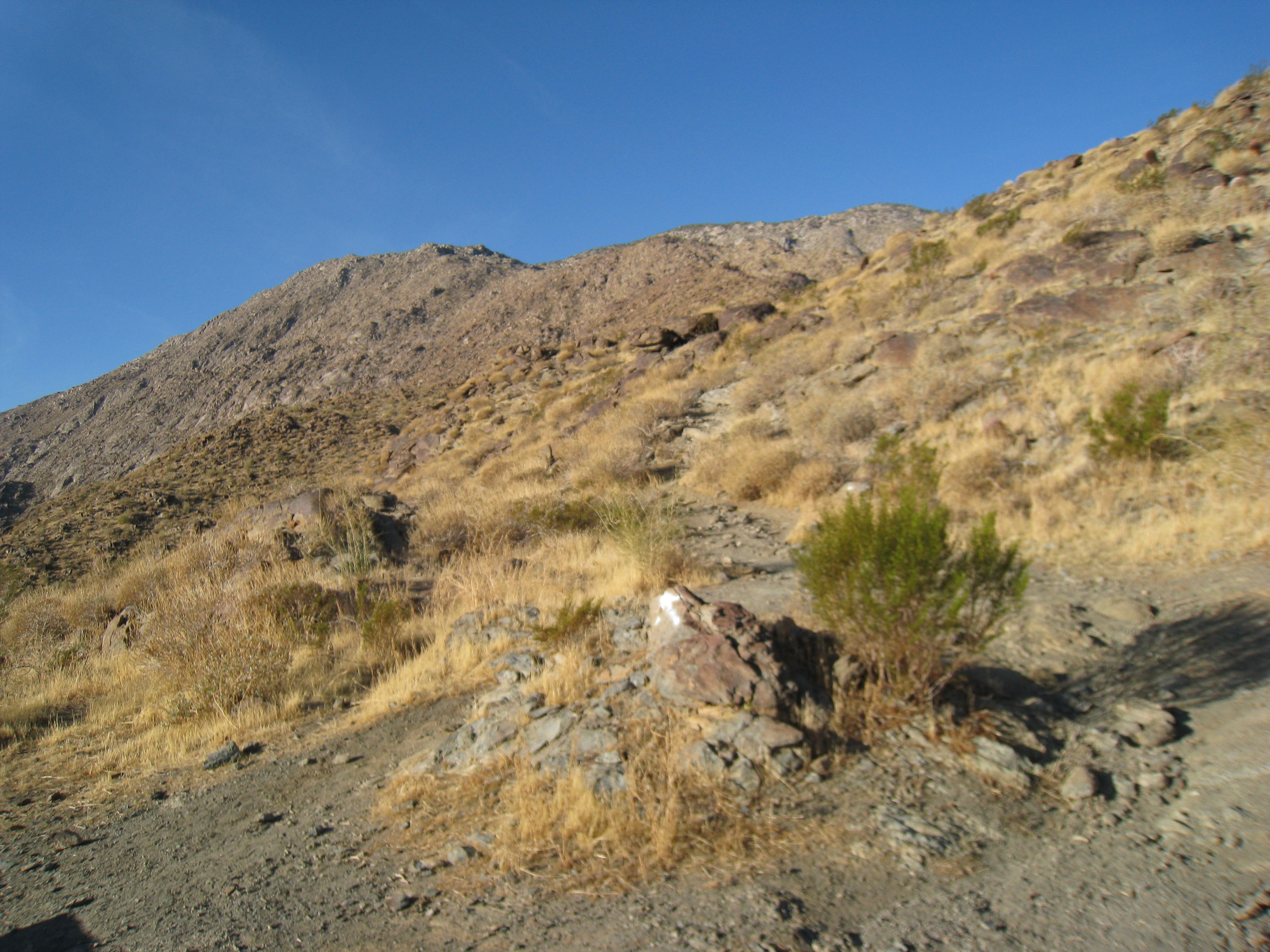
The trail heading up. There isn't much vegetation higher than your knees here. I can't imagine doing this trail in 100+ degree summer heat. It is in the low 50s right now, which will probably make the hike a lot easier.
9 The "sign" for the Skyline trail.
10 
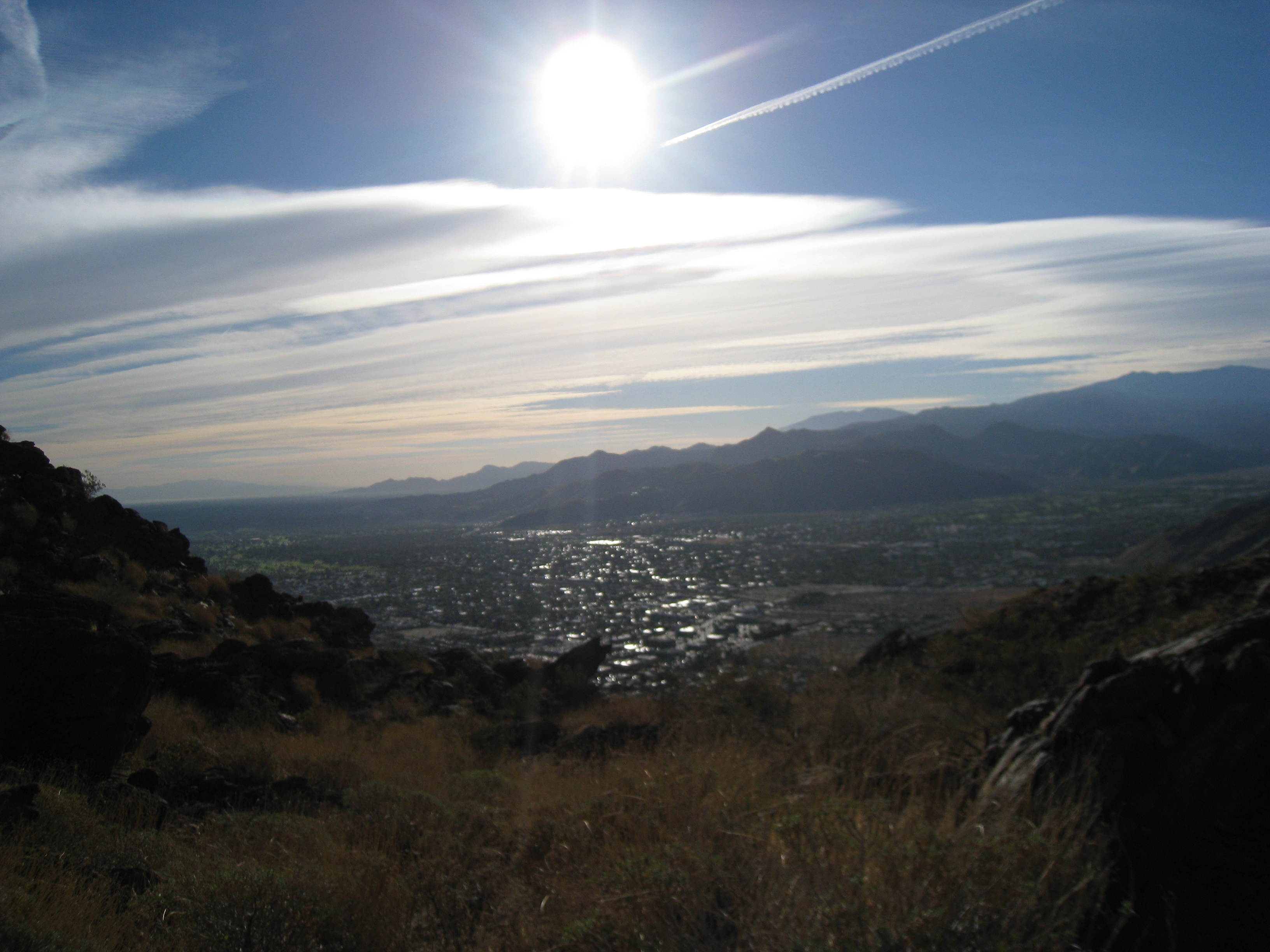
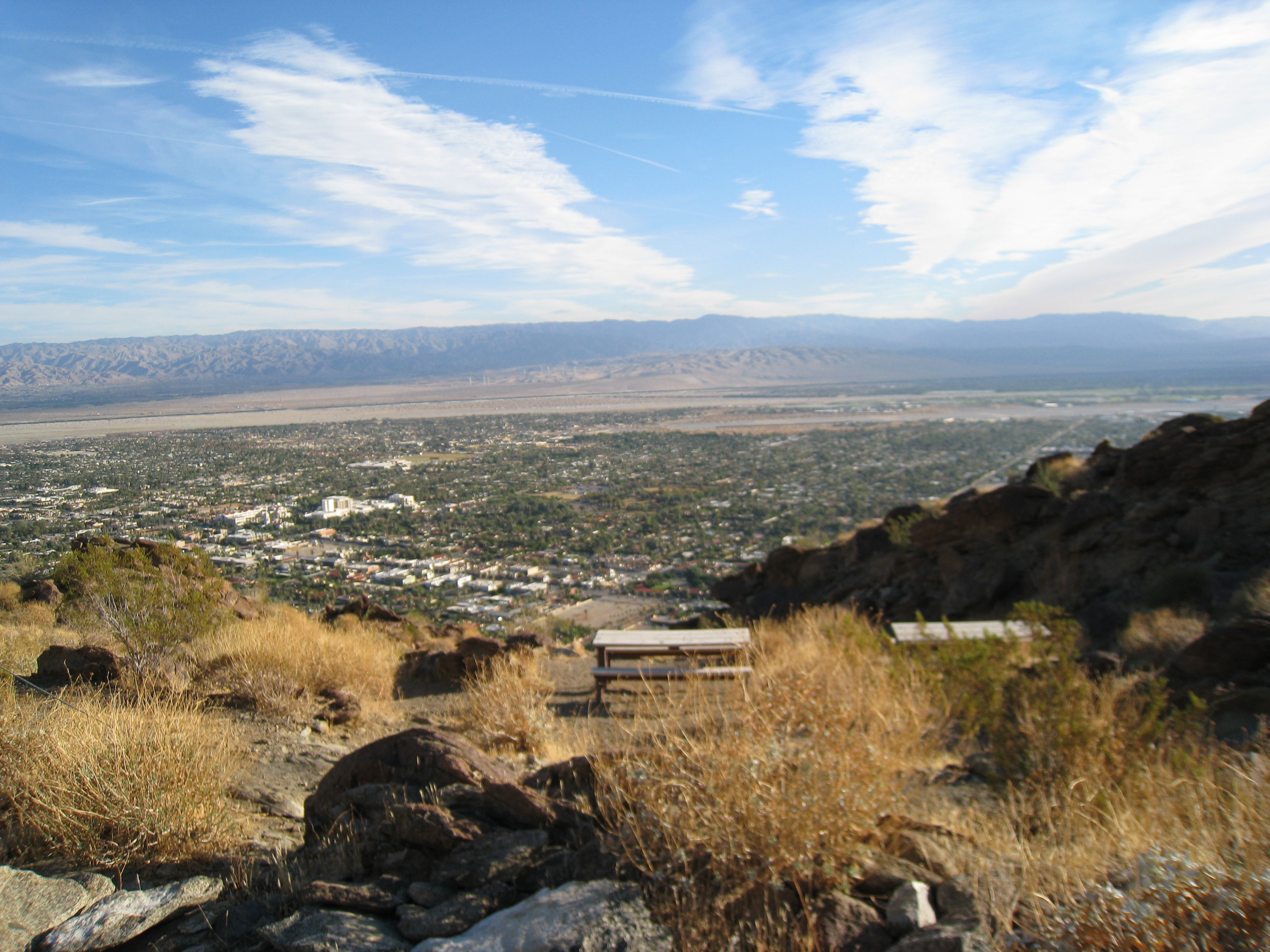
A look back down at Palm Springs, getting smaller and smaller as I ascend.
11 
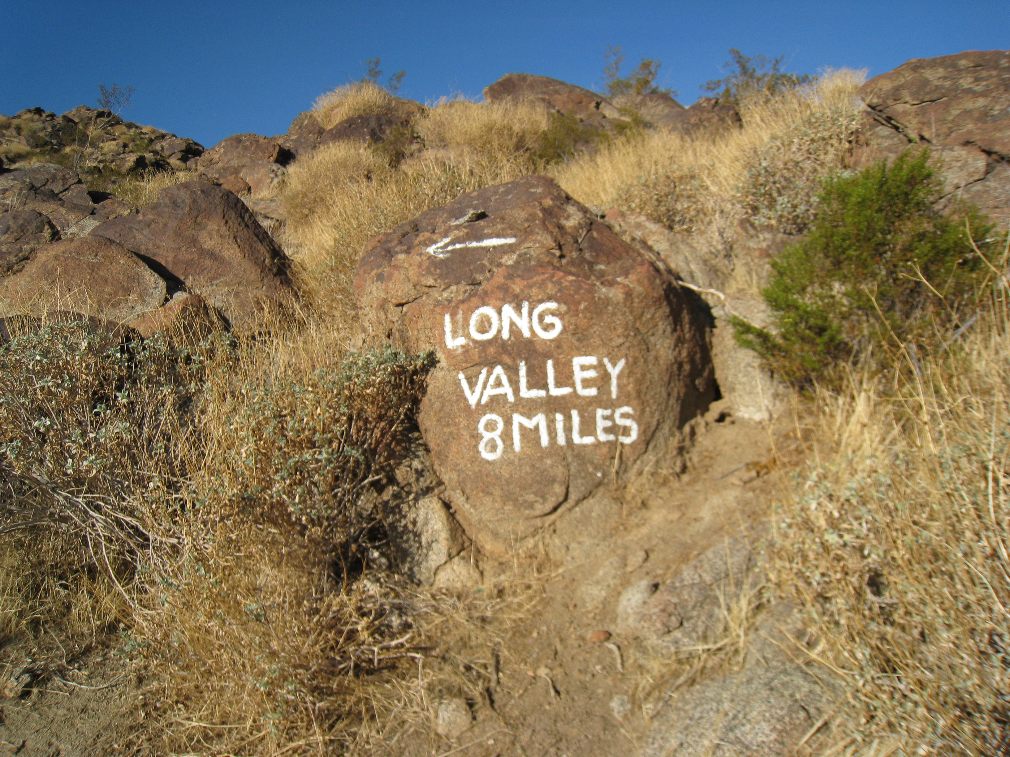
One of the famous rock signs. 8 miles to the Long Valley tram.
12 I have 3L of water in my new Osprey Manta pack, which should be more than enough for today, but probably not enough for a spring/summer trip.
13 
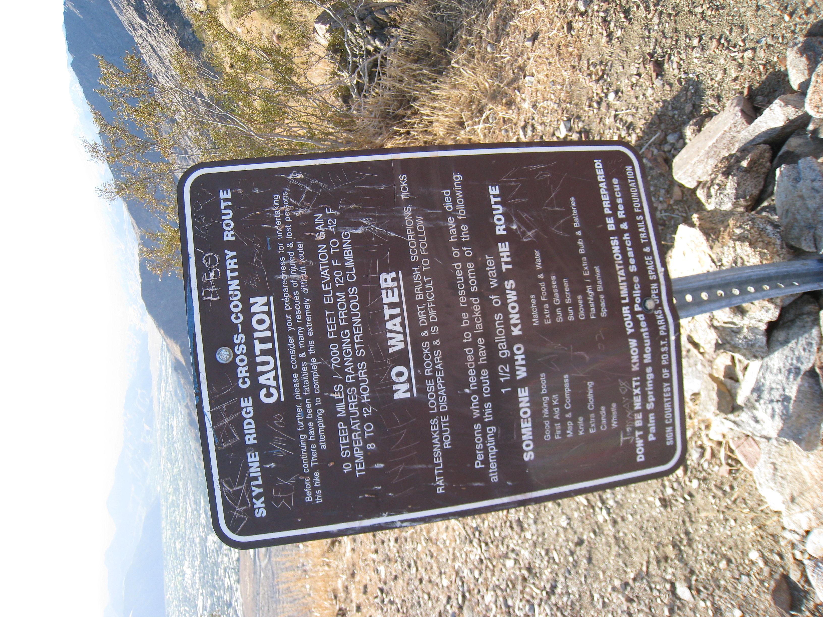
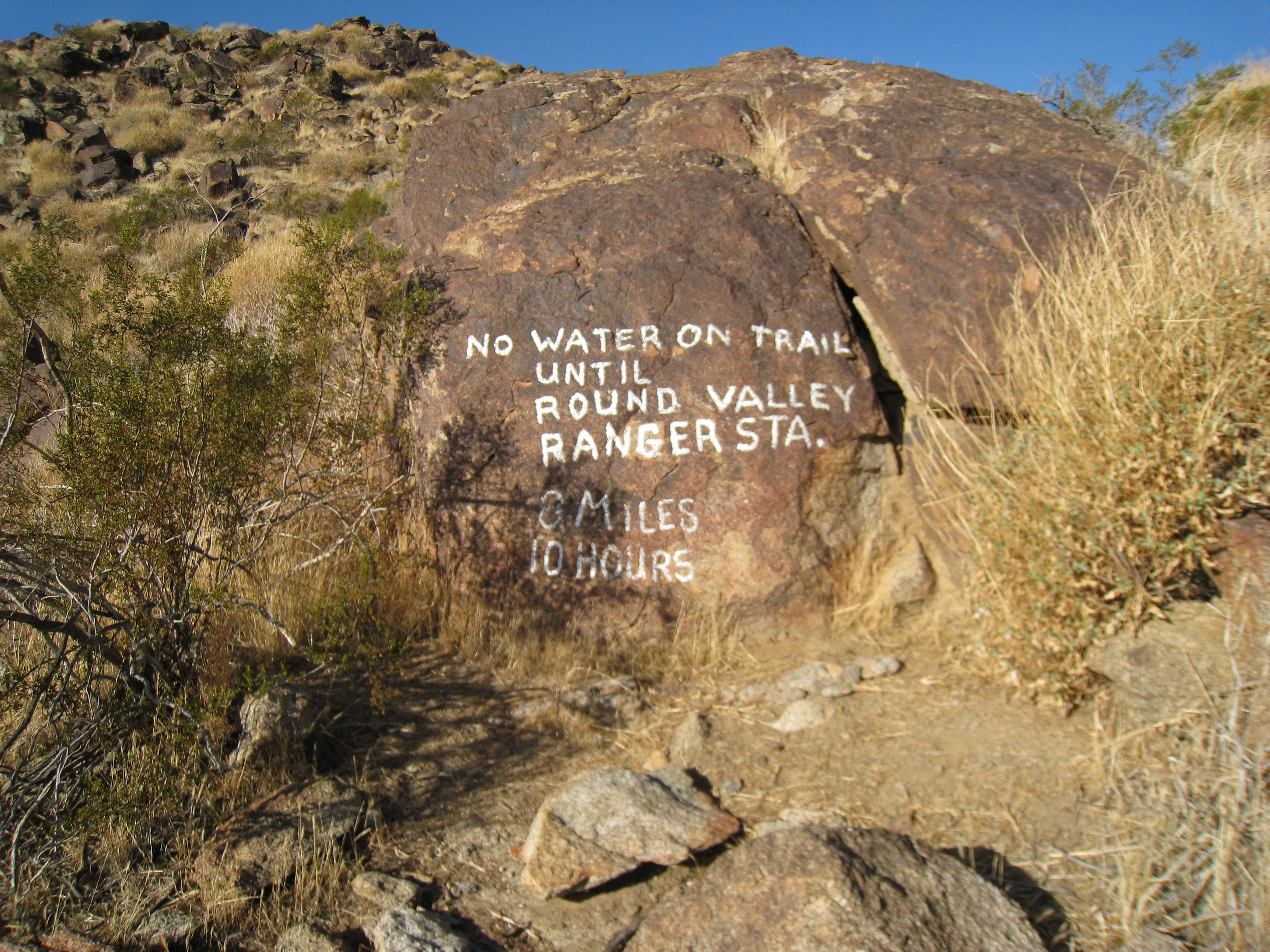
One of my favorite trail signs ever. You know if the sign mentions 'there have been fatalities and many rescues...' and 'persons that have needed to be rescued or have died attempting this route..', you must be on a serious trail!
14 
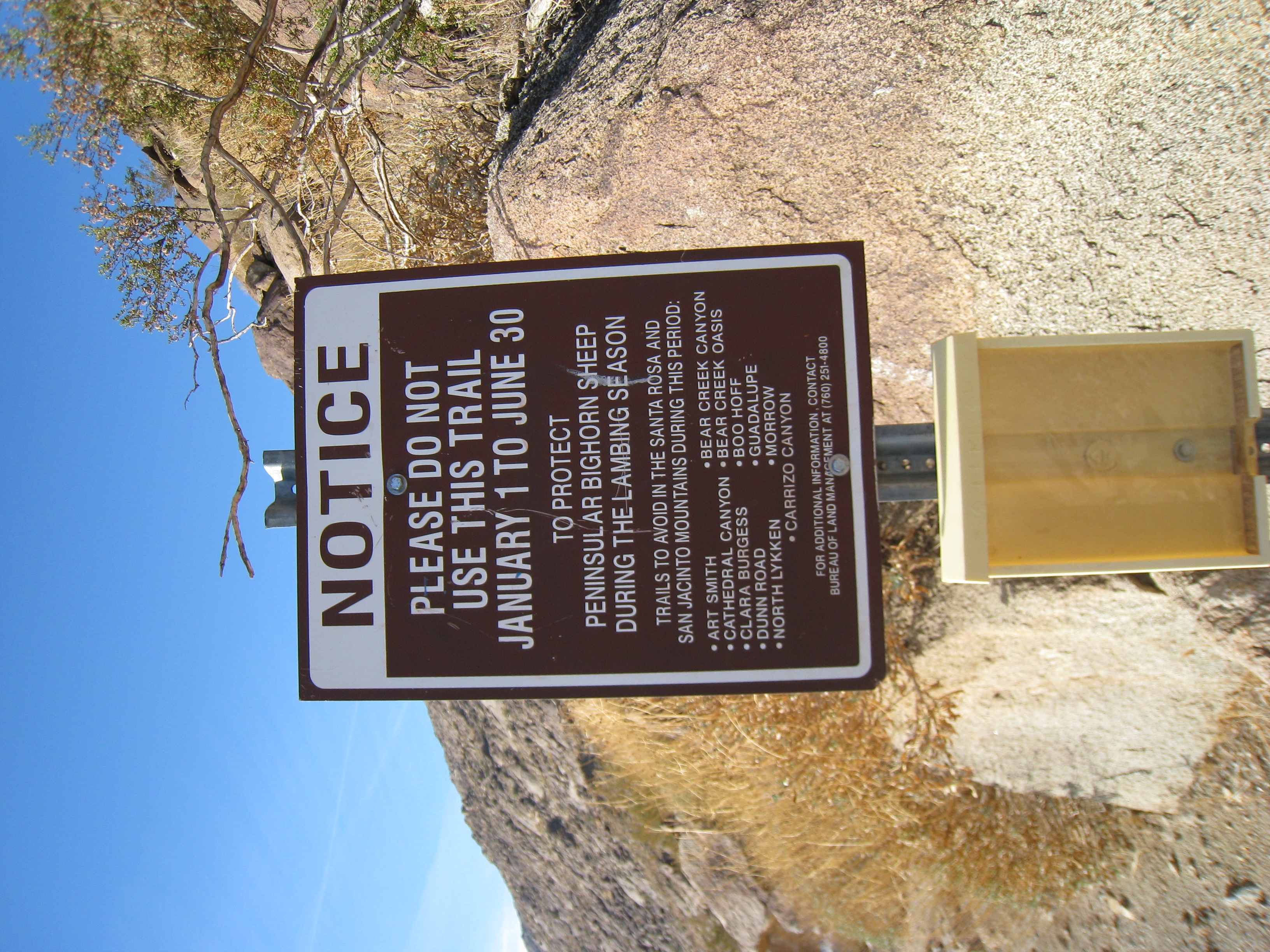
Another famous sign for those familar with the route. The trail is closed January through June to protect the Bighorn Sheep. It is not technically illegal though, and a lot of people still use it. Regardless, it is late November, so I shouldn't be disturbing any pregnant sheep.
15 
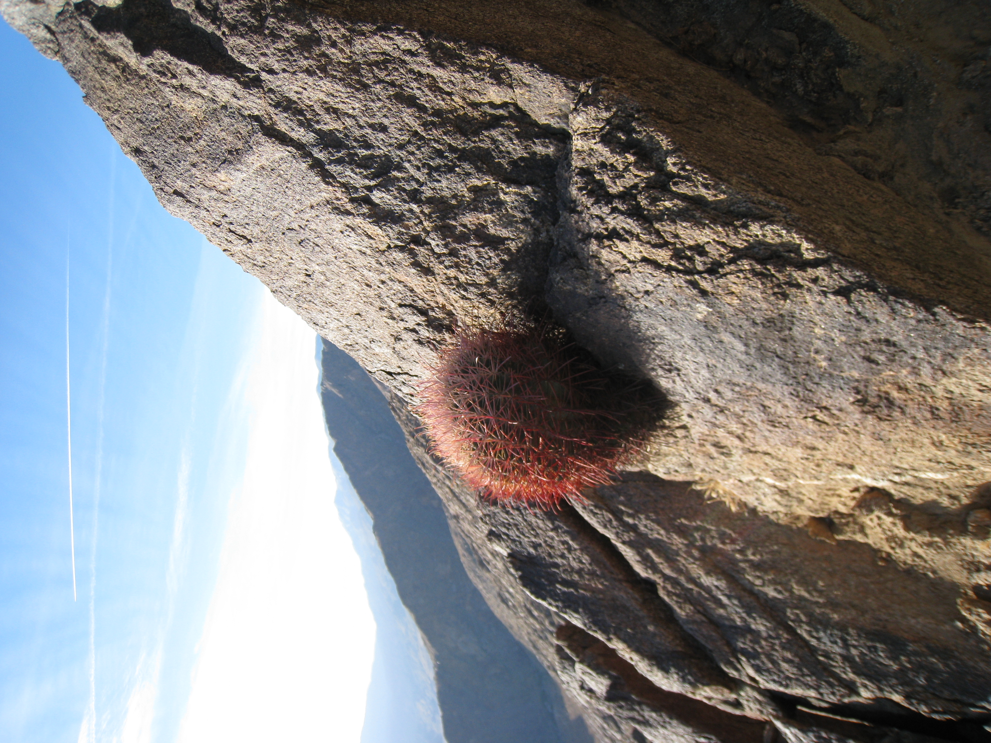
A cactus growing straight out of the rock.
16 
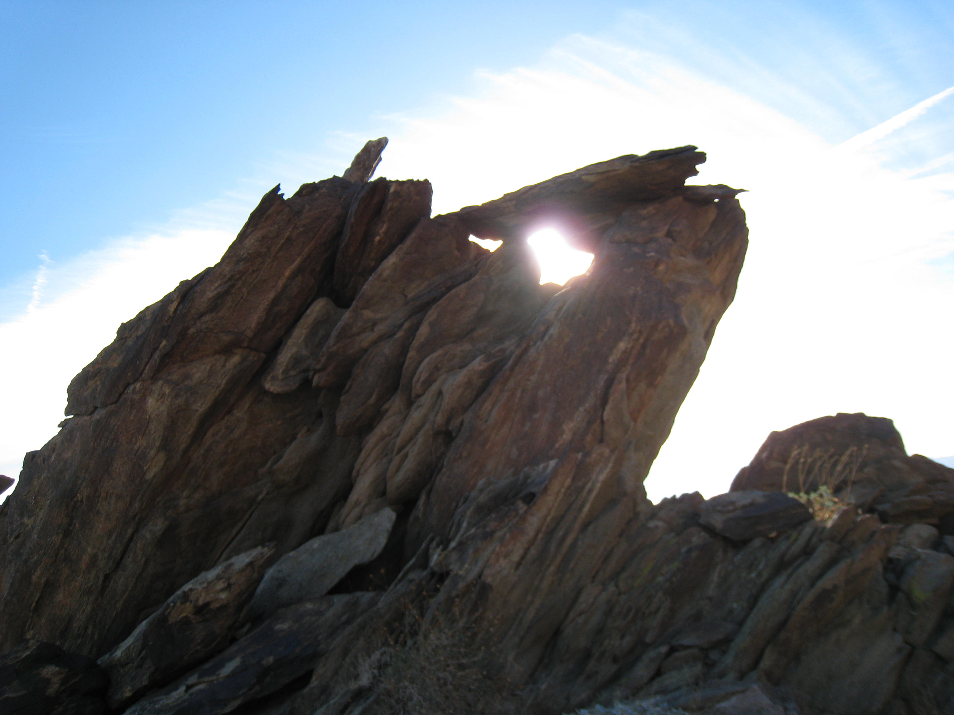
Morning sun through the rocks. There are some amazing rock formations up here.
17 
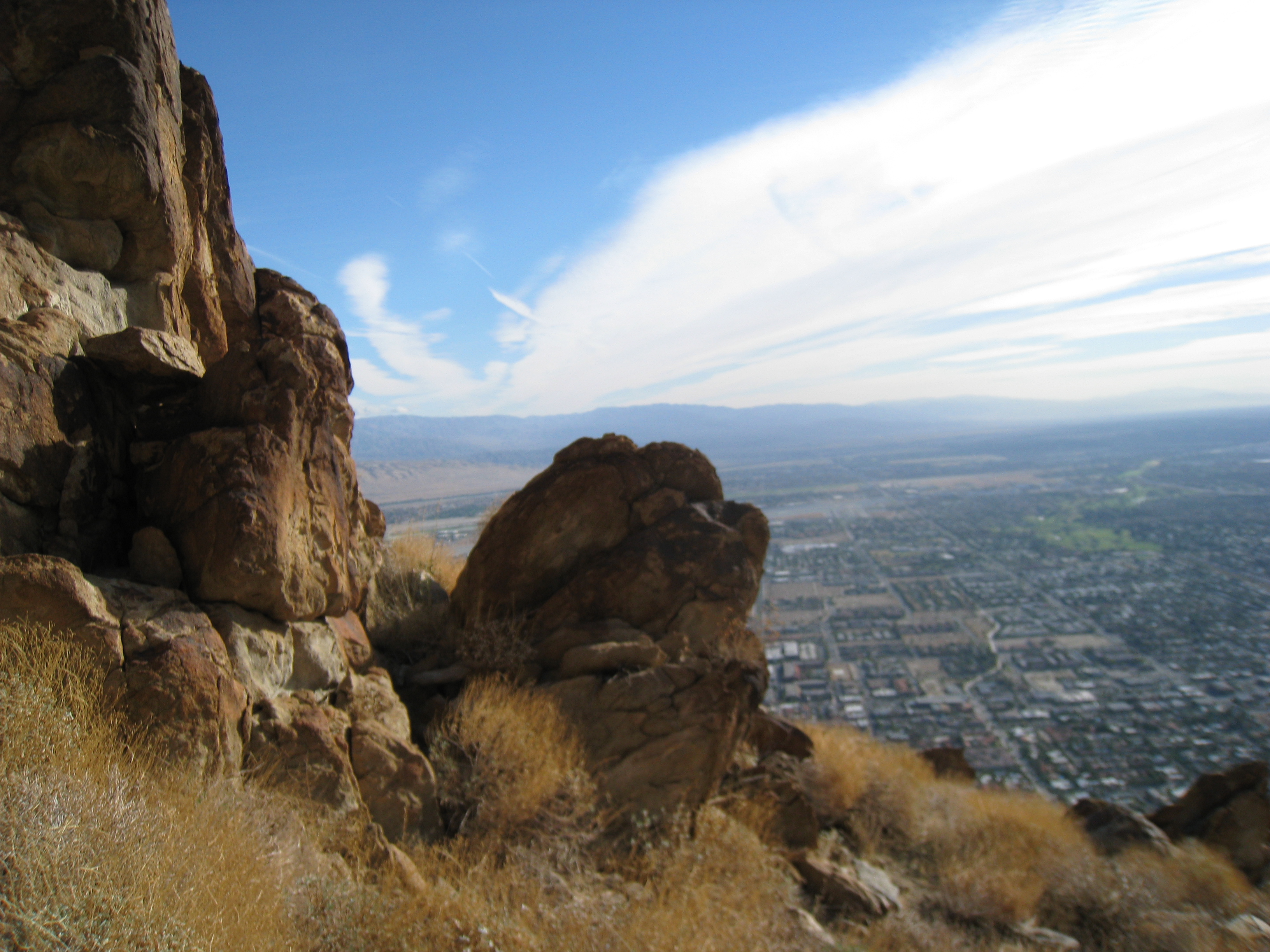
Rock formation with Palm Springs in the distance.
18 
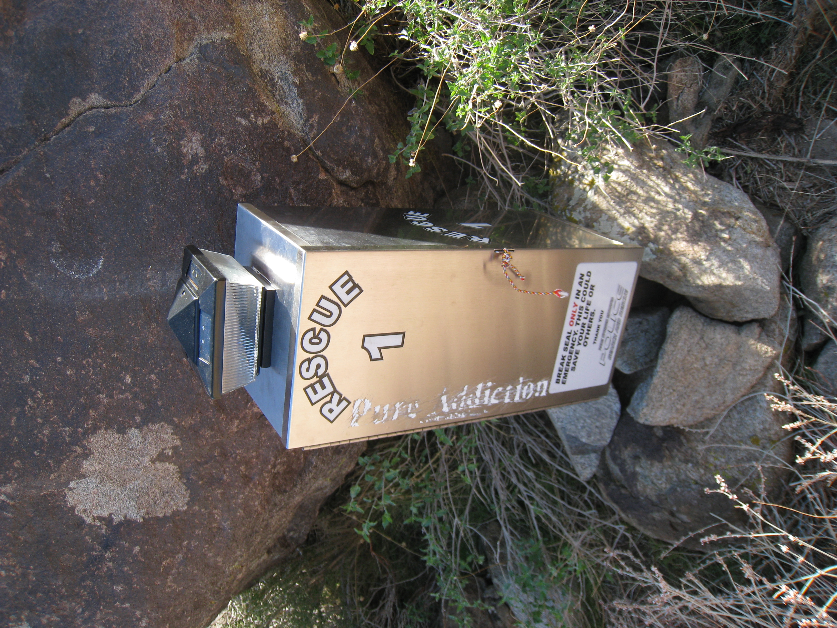
Rescue beacon. There have been enough rescues and fatalities on the trail that Search and Rescue has installed two beacons along the route. Google Cactus to Clouds to read accounts of some of those stories.
19 
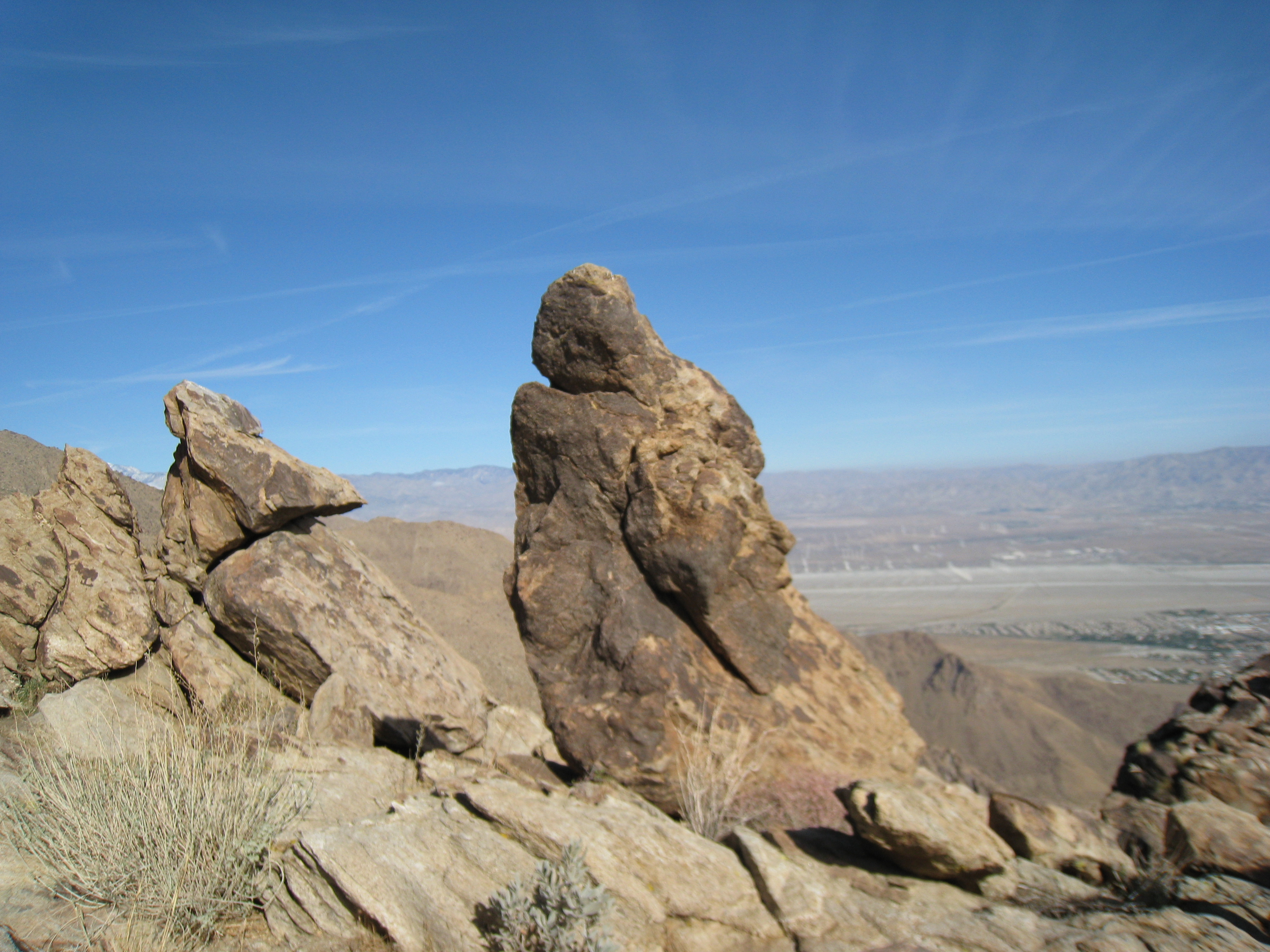
More cool rocks. I normally don't like desert trails, but this one was consistently fascinating.
20 
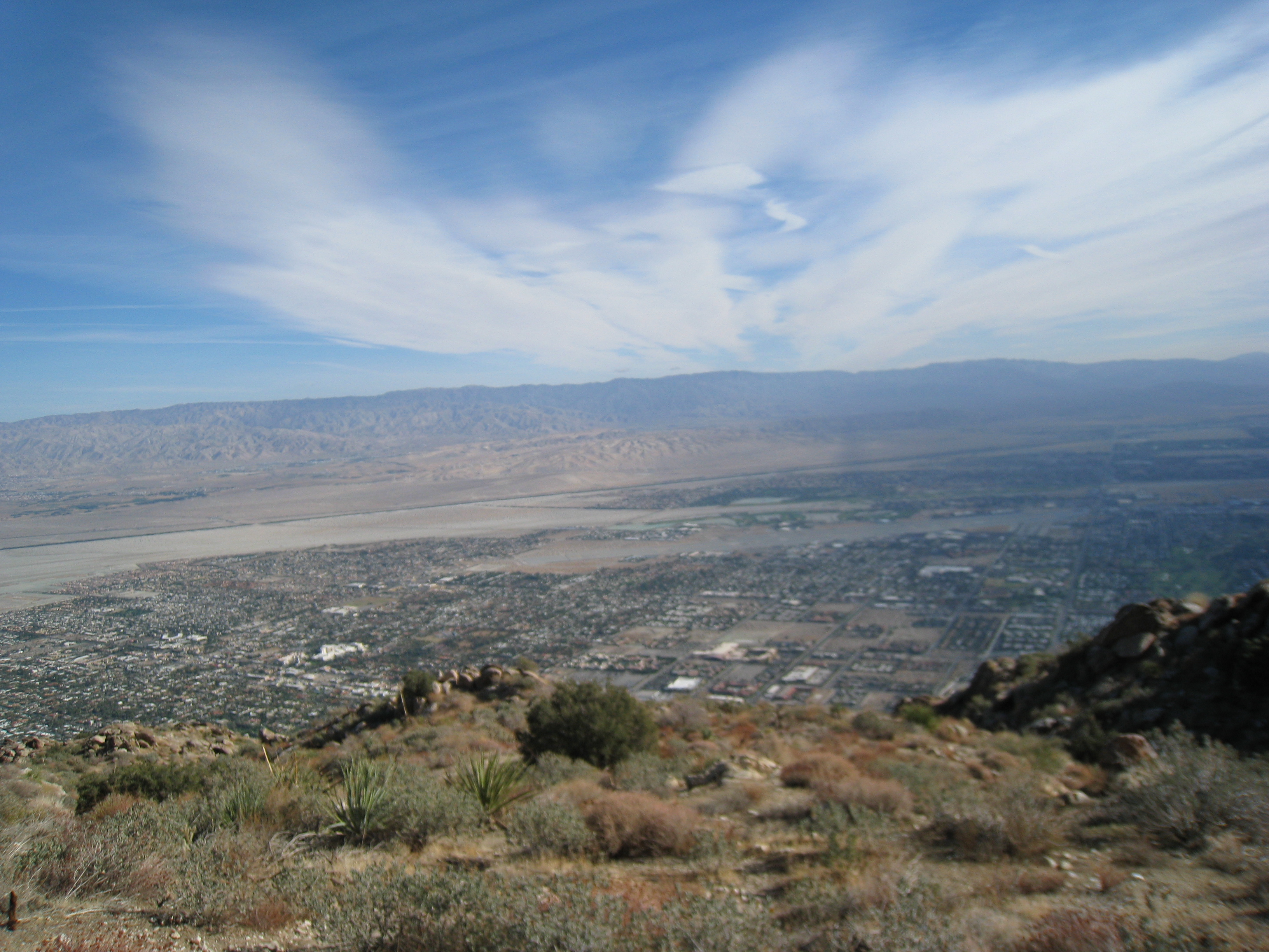
Over 3000' above the valley floor.
21 Starting to get into typical San Jacinto mountainous terrain. The first few thousand feet of gain were essentially climbing through a giant rock pile. Segments of "trail" constantly split and then merged again. When in doubt, just head up!
22 Green! Some of the first real, green vegatation starts to appear at almost exactly 4000'. Mt. San Gorgonio is in the distance.
23 First signs of snow. Some traces of frost/snow start to appear at just over 4000'.
24 Off season Yucca. Some huge old Yucca plants without their spring flowers.
25 The first clear view of the ridge at Long Valley. Another classic example of a picture not doing the terrain justice. In person, it looks about like a cliff just below the ridge. The trail must go around, not over that, right?
26 Zoomed-in picture of the tram at the top. You can see the cables, one of the towers, and the end of the line.
27 A really impressive looking valley. This is where the tram comes up 5400' in something like 15 minutes.
28 Free water. I guess this is where hikers leave extra water for the less fortunate. Good thing I wasn't desperate for water, because it's empty.
29 The first real snow patch along the trail at about 5500'.
30 The ground is pretty well blanketed by 6000'. It is really bizarre to see snow in what otherwise still feels like the desert.
31 Snowy trail winding through old chapparal plants.
32 The trail is steep and the snow is slippery. Fortunately there have been a few hikers here since the snow, so I have tracks to follow, and toe-in steps to use.
33 At about 7000' you start to move into the sub-alpine level and now have some tree cover. It's also now starting to get pretty cold. Feels like 30s, and I am still in shorts and a short sleeve tech shirt. I stop to put on long sleeves and light gloves.
34 A zoomed-in view of a tram car, which you can see just passing the tower.
35 The snow is probably 4-5 inches deep everywhere now. Fortunately it is cold and therefore not slushy, so I'm staying pretty dry. However, I am not wearing my waterproof trail running shoes (I had some silly notion that I would actually be running this trail), and my left big toe is starting to get pretty numb. Why is it always my left big toe?
36 There are a couple sections of relatively steep traversing here. No big deal with my crampons and ice axe. But I have neither today and I am not feeling very confident in my footing. I had set 2:00pm as my absolute, drop-dead turnaround time to make it back down with minimal headlamp time. It is about that time and the ridge is so close. I really want a definitive destination, so I decide to keep pressing on for the ridge.
37 It must be cold, there are icicles everywhere.
38 It's starting to look and feel like the Sierras. I believe this is called Coffman’s Crag, very impressive.
39 Almost to the ridge. This has been one of those torturous, never ending, "treadmill", peaks, but I think I'm really almost there. My fingers are starting to go numb at this point. I have only my light running gloves that have now been in the snow several times recovering from slips.
40 Brrr. I hit the ridge and the winds kick up. It's in the low to mid 20s. I am still in shorts and a long sleeve tech shirt. I'm beginning to think that's not too smart, so I stop to put on my sweats and wind shell.
41 I'm now in Long Valley. There are lots of people that came up the tram strolling around. They're bundled up in parkas and ski jackets and were looking at me in my shorts and t-shirt like I was from outer space.
42 From here the route continues to the top. Another roughly 5 miles and 2400'. One of these times I will be doing that for sure. Evidently the tram station is very close, so I decide to check it out.
43 A look down the path leading up to the tram station. I really hate the idea of there being a tram ride to the top, but I must say it is pretty darn cool. And it's cool seeing elderly folk and little kids up here that wouldn't make it otherwise. Lots of kids on sleds, snowball fights, etc.
44 The tram station, which is really a big lodge.
45 The jaw dropping view from one of the balconies of the lodge.
46 The obligatory 360 video, though a bit different than my normal peak view.
47 Another view from the lodge.
48 A picture of me on the lodge balcony.
49 There is a full cafe, bar, gift shop, etc. here. People are eating huge hamburgers and it's really warm in here. Am I seriously considering hiking back down 8500' in the cold (and soon to be dark) when I could be down in 20 minutes on the tram? Yes, stupidly enough, I am.
50 The Long Valley ranger station. Not quite what I imagined it would be, but cool nonetheless. The ranger asked 'Did you just do a hike?'. I said 'Ya, I just came up from Palm Springs on Skyline'. And he replied, 'Uh, we DON'T want to hear that!'. He asked if it was icy, and I said not too bad. He gave me a scornful look.
51 At this point, I went back outside and started the long trek back. It took every ounce of will power I had to walk away from the tram ticket booth and head back out into the freezing cold. Now that I was well rested I was re-running the time numbers in my head and realized I would probably be at least 2-3 hours in the dark on the way down (it is about 2:30pm at this point). On a normal trail, I would have no problem with that. But given that this trail is steep, very technical, and tough to follow in places, I was not feeling very confident. The ranger had warned me that the trail was much harder to follow on the way down. Decisions, decisions...
52 After making it down to the bottom of the hill from the lodge I decided to save the round trip for another day. Navigating the steep snow in the dim light was more than I felt like for the day. So I headed back to the (very warm) lodge. Problem now is that I only have $20 on me. The tram down is $12 and taxi back to my car would be $20-$30. I had read that it was only a few miles from the tram to the Museum, but the ranger confidently said it was upwards of 10 miles. And I certainly didn't feel like walking (or hitchhiking) 10 miles of highway.
53 After pleaing with the worker at the tram ticket counter, and giving her my sob story, she let me go through without paying and called a cab for me to be waiting at the bottom.
54 If you haven't been on the tram before, it's worth a trip, in and of itself. It rotates around 360 degrees as it descends 5400'. Pretty cool. Here's a look out the window.
55 Another look out the tram window, this time back towards the mountain.
56 I made it down. The tram ride was just a wee bit easier than the hike would have been! The taxi ride ended-up being $22 plus tip. It's now about 4:00pm and I'm headed-back home. Here's a look out the car window at the windmill farms.
57 A random picture on the drive out of Palm Springs. I actually still have energy and am feeling pretty good. Very rare for one my treks.
58 Mt. San Jacinto from the car window. A storm is starting to roll-in, so probably a good idea I came down early. Navigating the technical terrain in the dark in the rain would not have been fun. I definitely leave feeling a bit unfulfilled though. One of these times, I will definitely be doing Cactus to Clouds, all the way to the summit, in the snow.
59 Elevation profile for the route. The route actually includes several trails but is collectively known as Cactus to Clouds. Roughly 10,400' of point-to-point elevation gain and over 11,000' total. On today's trip, I did about 8500' of it. Mile 8-9 is a roughly 1500' gain! Doing that in the snow was a b**ch!!
60 The GPS data from my Garmin shown on a Bing aerial view map.